Youganning geodata
Youganning (Qinghai) is a seat of a third-order administrative division; located in China in Asia/Shanghai (GMT+8) time zone. In our database, there are 1268 cities with bigger population. Compared to other cities in China, 74% of cities are located further ↓South; 93.3% of cities are located further →East and 97.8% of cities have lower elevation than Youganning. Note1


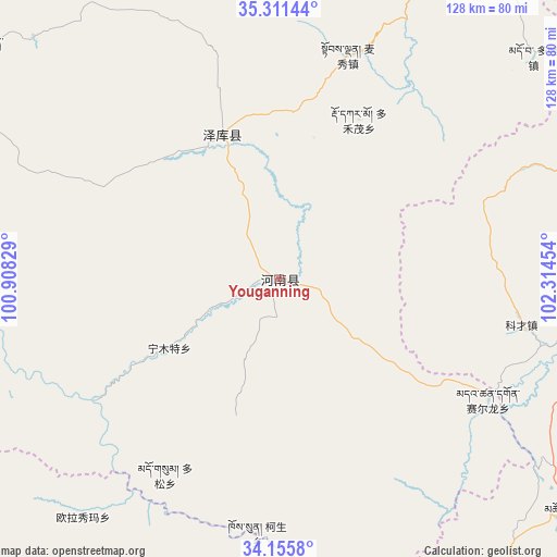
Youganning GPS coordinates[2]
34° 44' 8.304" North, 101° 36' 41.076" East
| Map corner | latitude | longitude |
|---|---|---|
| Upper-left | 35.31144°, | 100.90829° |
| Center: | 34.73564°, | 101.61141° |
| Lower-right: | 34.1558°, | 102.31454° |
| Map W x H: | 128.5×128.5 km | = 79.8×79.8mi |
| max Lat: | 53.31946° ⇑26% North |
| Youganning: | 34.73564° |
| min Lat: | ⇓74% South 18.22056° |
| min Long | Youganning | max Long |
| 75.07348° | 101.61141° | 134.28917° |
| W 6.7%⇐ | ⇒93.3% E |
Elevation
Elevation of Youganning is 3527 m = 11572 ft, and this is 3042.2 m = 9981 ft above average elevation for this country.
| Max E: |
5622 m = 18445 ft | 2.2% |
| Youganning | 3527 m 11572 ft | |
| Avg. | 484.8 m = 1591 ft | |
Min E: |
-3 m = -10 ft | 97.8% |
See also: China elevation on elevation.city.
Geographical zone
Youganning is located in North temperate zone (between Tropic of Cancer and the Arctic Circle). Distance of this Northern Tropic circle is 1256.3 km =780.6 mi to South.| Distance of | km | miles | from Youganning |
|---|---|---|---|
| North Pole | 6144.8 | 3818.2 | to North |
| Arctic Circle | 3538.9 | 2199 | to North |
| Tropic Cancer | 1256.3 | 780.6 | to South |
| Equator | 3862.2 | 2399.9 | to South |


Nearby cities:
15 places around Youganning: (largest is in red/bold)
• Dogarmo
41.1 km =25.5 mi,  26°
26°
• Duofudu
54.1 km =33.6 mi,  17°
17°
• Duosong
52.4 km =32.6 mi,  210°
210°
• Duowa
77.5 km =48.2 mi,  48°
48°
• Hor
79.3 km =49.3 mi,  314°
314°
• Kesheng
58.8 km =36.5 mi,  185°
185°
• Ningmute
29.9 km =18.6 mi,  238°
238°
• Oula
74 km =46 mi,  172°
172°
• Oula Xiuma
71 km =44.1 mi,  219°
219°
• Qiakeri
36.3 km =22.6 mi,  339°
339°
• Sai’erlong Xiang
55.5 km =34.5 mi,  120°
120°
• Sangke
61.1 km =38 mi, 47°
• Tuoyema
16.9 km =10.5 mi, 205°
• Xibusha
33.7 km =20.9 mi,  13°
13°
• Zhamao
72.6 km =45.1 mi, 21°
Sources, notices
• [Note1] Compared only with cities in China existing in our database
• [Src1] Map data: © OpenStreetMap contributors (CC-BY-SA)
• [Src2] Other city data from geonames.org with taken over terms of usage.
• [Src3] Geographical zone / Annual Mean Temperature by Robert A. Rohde @ Wikipedia
