Bukui geodata
Bukui (Heilongjiang) is a seat of a third-order administrative division; located in China in Asia/Shanghai (GMT+8) time zone. In our database, there are 1268 cities with bigger population. Compared to other cities in China, 97.7% of cities are located further ↓South; 93.7% of cities are located further ←West and 51% of cities have higher elevation than Bukui. Note1


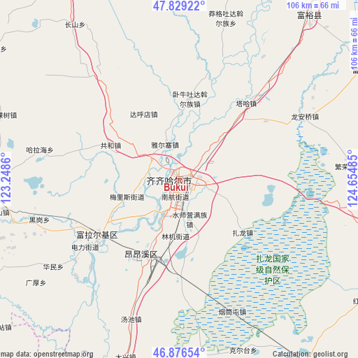
Bukui GPS coordinates[2]
47° 21' 18.108" North, 123° 57' 6.192" East
| Map corner | latitude | longitude |
|---|---|---|
| Upper-left | 47.82922°, | 123.2486° |
| Center: | 47.35503°, | 123.95172° |
| Lower-right: | 46.87654°, | 124.65485° |
| Map W x H: | 105.9×105.9 km | = 65.8×65.8mi |
| max Lat: | 53.31946° ⇑2.3% North |
| Bukui: | 47.35503° |
| min Lat: | ⇓97.7% South 18.22056° |
| min Long | Bukui | max Long |
| 75.07348° | 123.95172° | 134.28917° |
| W 93.7%⇐ | ⇒6.3% E |
Elevation
Elevation of Bukui is 156 m = 512 ft, and this is 328.8 m = 1079 ft below average elevation for this country.
| Max E: |
5622 m = 18445 ft | 51% |
| Avg. | 484.8 m = 1591 ft | |
| Bukui | 156 m = 512 ft | |
Min E: |
-3 m = -10 ft | 49% |
See also: China elevation on elevation.city.
Geographical zone
Bukui is located in North temperate zone (between Tropic of Cancer and the Arctic Circle). Distance of this North polar circle is 2135.8 km =1327.1 mi to North.| Distance of | km | miles | from Bukui |
|---|---|---|---|
| North Pole | 4741.7 | 2946.4 | to North |
| Arctic Circle | 2135.8 | 1327.1 | to North |
| Tropic Cancer | 2659.5 | 1652.5 | to South |
| Equator | 5265.4 | 3271.8 | to South |


Nearby cities:
15 places around Bukui: (largest is in red/bold)
• Dahudian
22.1 km =13.7 mi,  331°
331°
• Damin
10.5 km =6.5 mi,  200°
200°
• Gonghe
22.7 km =14.1 mi,  296°
296°
• Hali
22.6 km =14 mi,  262°
262°
• Hulan Ergi
29.3 km =18.2 mi,  235°
235°
• Longhua
2.8 km =1.7 mi,  131°
131°
• Meilisi
15.5 km =9.6 mi,  253°
253°
• Nanhang
4.5 km =2.8 mi,  183°
183°
• Qiqihar
1.7 km =1.1 mi,  157°
157°
• Shuishiying
12.3 km =7.6 mi,  166°
166°
• Woniutu
23.2 km =14.4 mi,  6°
6°
• Xinxing
24.7 km =15.3 mi,  205°
205°
• Ya’ersai
10.9 km =6.8 mi,  339°
339°
• Yushutun
22.8 km =14.2 mi,  192°
192°
• Zhalong
24.6 km =15.3 mi, 130°
Sources, notices
• [Note1] Compared only with cities in China existing in our database
• [Src1] Map data: © OpenStreetMap contributors (CC-BY-SA)
• [Src2] Other city data from geonames.org with taken over terms of usage.
• [Src3] Geographical zone / Annual Mean Temperature by Robert A. Rohde @ Wikipedia
