Longhua geodata
Longhua (Heilongjiang) is a seat of a third-order administrative division; located in China in Asia/Shanghai (GMT+8) time zone. In our database, there are 1268 cities with bigger population. Compared to other cities in China, 97.7% of cities are located further ↓South; 93.7% of cities are located further ←West and 51.8% of cities have higher elevation than Longhua. Note1


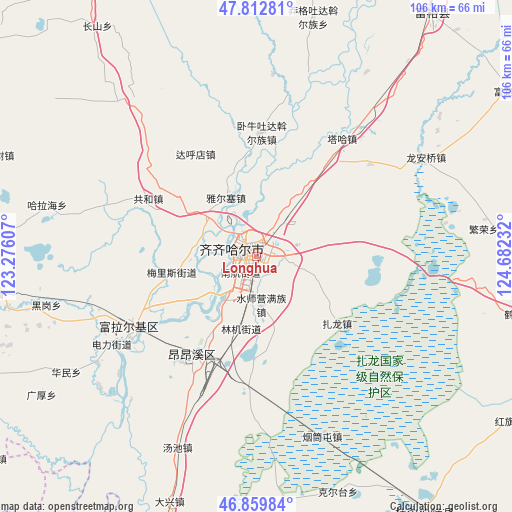
Longhua GPS coordinates[2]
47° 20' 18.492" North, 123° 58' 45.084" East
| Map corner | latitude | longitude |
|---|---|---|
| Upper-left | 47.81281°, | 123.27607° |
| Center: | 47.33847°, | 123.97919° |
| Lower-right: | 46.85984°, | 124.68232° |
| Map W x H: | 106×106 km | = 65.9×65.9mi |
| max Lat: | 53.31946° ⇑2.3% North |
| Longhua: | 47.33847° |
| min Lat: | ⇓97.7% South 18.22056° |
| min Long | Longhua | max Long |
| 75.07348° | 123.97919° | 134.28917° |
| W 93.7%⇐ | ⇒6.3% E |
Elevation
Elevation of Longhua is 151 m = 495 ft, and this is 333.8 m = 1095 ft below average elevation for this country.
| Max E: |
5622 m = 18445 ft | 51.8% |
| Avg. | 484.8 m = 1591 ft | |
| Longhua | 151 m = 495 ft | |
Min E: |
-3 m = -10 ft | 48.2% |
See also: China elevation on elevation.city.
Geographical zone
Longhua is located in North temperate zone (between Tropic of Cancer and the Arctic Circle). Distance of this North polar circle is 2137.6 km =1328.2 mi to North.| Distance of | km | miles | from Longhua |
|---|---|---|---|
| North Pole | 4743.5 | 2947.5 | to North |
| Arctic Circle | 2137.6 | 1328.2 | to North |
| Tropic Cancer | 2657.6 | 1651.4 | to South |
| Equator | 5263.5 | 3270.6 | to South |


Nearby cities:
15 places around Longhua: (largest is in red/bold)
• Bukui
2.8 km =1.7 mi,  311°
311°
• Dahudian
24.7 km =15.3 mi,  329°
329°
• Damin
9.9 km =6.2 mi,  215°
215°
• Gonghe
25.3 km =15.7 mi,  298°
298°
• Hali
24.5 km =15.2 mi,  267°
267°
• Meilisi
17.1 km =10.6 mi,  261°
261°
• Nanhang
3.5 km =2.2 mi, 221°
• Qiqihar
1.4 km =0.9 mi,  280°
280°
• Shuishiying
10.1 km =6.3 mi,  175°
175°
• Taha Man Zu
30.1 km =18.7 mi,  36°
36°
• Woniutu
24.9 km =15.5 mi,  1°
1°
• Xinxing
24.1 km =15 mi,  212°
212°
• Ya’ersai
13.4 km =8.3 mi, 333°
• Yushutun
21.5 km =13.4 mi,  198°
198°
• Zhalong
21.9 km =13.6 mi,  130°
130°
Sources, notices
• [Note1] Compared only with cities in China existing in our database
• [Src1] Map data: © OpenStreetMap contributors (CC-BY-SA)
• [Src2] Other city data from geonames.org with taken over terms of usage.
• [Src3] Geographical zone / Annual Mean Temperature by Robert A. Rohde @ Wikipedia
