Lüjiabao geodata
Lüjiabao (Gansu) is a seat of a fourth-order administrative division; located in China in Asia/Urumqi (GMT+6) time zone. In our database, there are 1268 cities with bigger population. Compared to other cities in China, 87.2% of cities are located further ↓South; 96.2% of cities are located further →East and 87.2% of cities have lower elevation than Lüjiabao. Note1


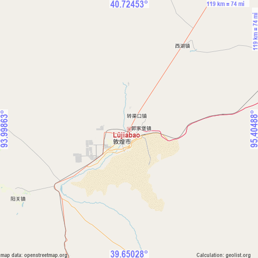
Lüjiabao GPS coordinates[2]
40° 11' 22.308" North, 94° 42' 6.3" East
| Map corner | latitude | longitude |
|---|---|---|
| Upper-left | 40.72453°, | 93.99863° |
| Center: | 40.18953°, | 94.70175° |
| Lower-right: | 39.65028°, | 95.40488° |
| Map W x H: | 119.4×119.4 km | = 74.2×74.2mi |
| max Lat: | 53.31946° ⇑12.8% North |
| Lüjiabao: | 40.18953° |
| min Lat: | ⇓87.2% South 18.22056° |
| min Long | Lüjiabao | max Long |
| 75.07348° | 94.70175° | 134.28917° |
| W 3.8%⇐ | ⇒96.2% E |
Elevation
Elevation of Lüjiabao is 1125 m = 3691 ft, and this is 640.2 m = 2100 ft above average elevation for this country.
| Max E: |
5622 m = 18445 ft | 12.8% |
| Lüjiabao | 1125 m 3691 ft | |
| Avg. | 484.8 m = 1591 ft | |
Min E: |
-3 m = -10 ft | 87.2% |
See also: China elevation on elevation.city.
Geographical zone
Lüjiabao is located in North temperate zone (between Tropic of Cancer and the Arctic Circle). Distance of this Northern Tropic circle is 1862.7 km =1157.4 mi to South.| Distance of | km | miles | from Lüjiabao |
|---|---|---|---|
| North Pole | 5538.4 | 3441.4 | to North |
| Arctic Circle | 2932.5 | 1822.2 | to North |
| Tropic Cancer | 1862.7 | 1157.4 | to South |
| Equator | 4468.7 | 2776.7 | to South |


Nearby cities:
15 places around Lüjiabao: (largest is in red/bold)
• Dangchengwan
81.9 km =50.9 mi,  159°
159°
• Dongbatu
86.5 km =53.7 mi,  99°
99°
• Guojiabao
5.5 km =3.4 mi,  82°
82°
• Hongliuwan
69.4 km =43.1 mi,  206°
206°
• Huangqu
9.9 km =6.2 mi,  0°
0°
• Mengjiaqiao
7.4 km =4.6 mi,  262°
262°
• Nancha
85.1 km =52.9 mi,  73°
73°
• Qili
11.4 km =7.1 mi,  223°
223°
• Sanwei
4.3 km =2.7 mi,  180°
180°
• Shazhou
6.6 km =4.1 mi, 210°
• Suzhou
6 km =3.7 mi,  241°
241°
• Wudun
9.1 km =5.7 mi, 104°
• Xihu
45.9 km =28.5 mi,  32°
32°
• Yangjiaqiao
7.8 km =4.8 mi,  204°
204°
• Zhuanqukou
7.2 km =4.5 mi, 27°
Sources, notices
• [Note1] Compared only with cities in China existing in our database
• [Src1] Map data: © OpenStreetMap contributors (CC-BY-SA)
• [Src2] Other city data from geonames.org with taken over terms of usage.
• [Src3] Geographical zone / Annual Mean Temperature by Robert A. Rohde @ Wikipedia
