Nancha geodata
Nancha (Gansu) is a seat of a fourth-order administrative division; located in China in Asia/Urumqi (GMT+6) time zone. In our database, there are 1268 cities with bigger population. Compared to other cities in China, 87.8% of cities are located further ↓South; 95.9% of cities are located further →East and 87.6% of cities have lower elevation than Nancha. Note1


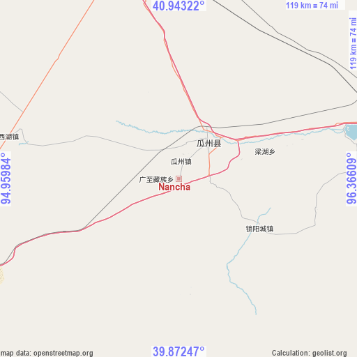
Nancha GPS coordinates[2]
40° 24' 35.892" North, 95° 39' 46.656" East
| Map corner | latitude | longitude |
|---|---|---|
| Upper-left | 40.94322°, | 94.95984° |
| Center: | 40.40997°, | 95.66296° |
| Lower-right: | 39.87247°, | 96.36609° |
| Map W x H: | 119.1×119.1 km | = 74×74mi |
| max Lat: | 53.31946° ⇑12.2% North |
| Nancha: | 40.40997° |
| min Lat: | ⇓87.8% South 18.22056° |
| min Long | Nancha | max Long |
| 75.07348° | 95.66296° | 134.28917° |
| W 4.1%⇐ | ⇒95.9% E |
Elevation
Elevation of Nancha is 1154 m = 3786 ft, and this is 669.2 m = 2196 ft above average elevation for this country.
| Max E: |
5622 m = 18445 ft | 12.4% |
| Nancha | 1154 m 3786 ft | |
| Avg. | 484.8 m = 1591 ft | |
Min E: |
-3 m = -10 ft | 87.6% |
See also: China elevation on elevation.city.
Geographical zone
Nancha is located in North temperate zone (between Tropic of Cancer and the Arctic Circle). Distance of this Northern Tropic circle is 1887.2 km =1172.7 mi to South.| Distance of | km | miles | from Nancha |
|---|---|---|---|
| North Pole | 5513.9 | 3426.2 | to North |
| Arctic Circle | 2908 | 1806.9 | to North |
| Tropic Cancer | 1887.2 | 1172.7 | to South |
| Equator | 4493.2 | 2791.9 | to South |


Nearby cities:
15 places around Nancha: (largest is in red/bold)
• Bulongji
75.5 km =46.9 mi,  79°
79°
• Dongbatu
38.8 km =24.1 mi,  174°
174°
• Guazhou
6 km =3.7 mi,  6°
6°
• Guojiabao
79.7 km =49.5 mi,  252°
252°
• Huancheng
15.8 km =9.8 mi,  33°
33°
• Huangqu
82.7 km =51.4 mi,  259°
259°
• Liuyuan
78.2 km =48.6 mi,  350°
350°
• Lüjiabao
85.1 km =52.9 mi, 253°
• Qiaozi
46.6 km =29 mi,  101°
101°
• Shibaocheng
76 km =47.2 mi,  153°
153°
• Tashi
31.5 km =19.6 mi,  121°
121°
• Wudun
77.5 km =48.2 mi, 249°
• Xihu
58.6 km =36.4 mi,  284°
284°
• Yuanquan
15.3 km =9.5 mi,  49°
49°
• Zhuanqukou
80.2 km =49.8 mi, 256°
Sources, notices
• [Note1] Compared only with cities in China existing in our database
• [Src1] Map data: © OpenStreetMap contributors (CC-BY-SA)
• [Src2] Other city data from geonames.org with taken over terms of usage.
• [Src3] Geographical zone / Annual Mean Temperature by Robert A. Rohde @ Wikipedia
