Dangchengwan geodata
Dangchengwan (Gansu) is a seat of a third-order administrative division; located in China in Asia/Urumqi (GMT+6) time zone. In our database, there are 1268 cities with bigger population. Compared to other cities in China, 84.7% of cities are located further ↓South; 96.1% of cities are located further →East and 97.3% of cities have lower elevation than Dangchengwan. Note1


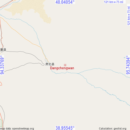
Dangchengwan GPS coordinates[2]
39° 30' 0.396" North, 95° 2' 26.916" East
| Map corner | latitude | longitude |
|---|---|---|
| Upper-left | 40.04054°, | 94.33769° |
| Center: | 39.50011°, | 95.04081° |
| Lower-right: | 38.95545°, | 95.74394° |
| Map W x H: | 120.7×120.7 km | = 75×75mi |
| max Lat: | 53.31946° ⇑15.3% North |
| Dangchengwan: | 39.50011° |
| min Lat: | ⇓84.7% South 18.22056° |
| min Long | Dangchengwan | max Long |
| 75.07348° | 95.04081° | 134.28917° |
| W 3.9%⇐ | ⇒96.1% E |
Elevation
Elevation of Dangchengwan is 3277 m = 10751 ft, and this is 2792.2 m = 9161 ft above average elevation for this country.
| Max E: |
5622 m = 18445 ft | 2.7% |
| Dangchengwan | 3277 m 10751 ft | |
| Avg. | 484.8 m = 1591 ft | |
Min E: |
-3 m = -10 ft | 97.3% |
See also: China elevation on elevation.city.
Geographical zone
Dangchengwan is located in North temperate zone (between Tropic of Cancer and the Arctic Circle). Distance of this Northern Tropic circle is 1786.1 km =1109.8 mi to South.| Distance of | km | miles | from Dangchengwan |
|---|---|---|---|
| North Pole | 5615.1 | 3489.1 | to North |
| Arctic Circle | 3009.2 | 1869.8 | to North |
| Tropic Cancer | 1786.1 | 1109.8 | to South |
| Equator | 4392 | 2729.1 | to South |


Nearby cities:
15 places around Dangchengwan: (largest is in red/bold)
• Dongbatu
84.5 km =52.5 mi,  42°
42°
• Guojiabao
80.9 km =50.3 mi,  343°
343°
• Hongliuwan
62.1 km =38.6 mi,  283°
283°
• Huangqu
91.2 km =56.7 mi, 341°
• Lüjiabao
81.9 km =50.9 mi, 339°
• Mengjiaqiao
83.9 km =52.1 mi,  334°
334°
• Qili
77.7 km =48.3 mi, 331°
• Sanwei
78 km =48.5 mi, 338°
• Shazhou
77.9 km =48.4 mi, 335°
• Shibaocheng
93.9 km =58.3 mi,  69°
69°
• Suzhou
81.3 km =50.5 mi, 335°
• Wudun
77.1 km =47.9 mi, 344°
• Yanchiwan
108.9 km =67.7 mi,  121°
121°
• Yangjiaqiao
76.7 km =47.7 mi, 335°
• Zhuanqukou
86.9 km =54 mi, 342°
Sources, notices
• [Note1] Compared only with cities in China existing in our database
• [Src1] Map data: © OpenStreetMap contributors (CC-BY-SA)
• [Src2] Other city data from geonames.org with taken over terms of usage.
• [Src3] Geographical zone / Annual Mean Temperature by Robert A. Rohde @ Wikipedia
