Futiansi geodata
Futiansi (Hubei) is a seat of a fourth-order administrative division; located in China in Asia/Shanghai (GMT+8) time zone. In our database, there are 1268 cities with bigger population. Compared to other cities in China, 55.1% of cities are located further ↑North; 57.1% of cities are located further →East and 78.8% of cities have higher elevation than Futiansi. Note1


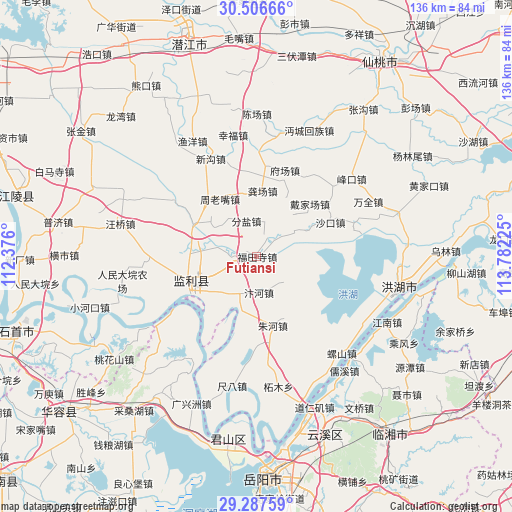
Futiansi GPS coordinates[2]
29° 53' 56.364" North, 113° 4' 44.832" East
| Map corner | latitude | longitude |
|---|---|---|
| Upper-left | 30.50666°, | 112.376° |
| Center: | 29.89899°, | 113.07912° |
| Lower-right: | 29.28759°, | 113.78225° |
| Map W x H: | 135.5×135.5 km | = 84.2×84.2mi |
| max Lat: | 53.31946° ⇑55.1% North |
| Futiansi: | 29.89899° |
| min Lat: | ⇓44.9% South 18.22056° |
| min Long | Futiansi | max Long |
| 75.07348° | 113.07912° | 134.28917° |
| W 42.9%⇐ | ⇒57.1% E |
Elevation
Elevation of Futiansi is 29 m = 95 ft, and this is 455.8 m = 1495 ft below average elevation for this country.
| Max E: |
5622 m = 18445 ft | 78.8% |
| Avg. | 484.8 m = 1591 ft | |
| Futiansi | 29 m = 95 ft | |
Min E: |
-3 m = -10 ft | 21.2% |
See also: China elevation on elevation.city.
Geographical zone
Futiansi is located in North temperate zone (between Tropic of Cancer and the Arctic Circle). Distance of this Northern Tropic circle is 718.5 km =446.5 mi to South.| Distance of | km | miles | from Futiansi |
|---|---|---|---|
| North Pole | 6682.6 | 4152.4 | to North |
| Arctic Circle | 4076.7 | 2533.1 | to North |
| Tropic Cancer | 718.5 | 446.5 | to South |
| Equator | 3324.5 | 2065.7 | to South |


Nearby cities:
15 places around Futiansi: (largest is in red/bold)
• Bianhe
9.2 km =5.7 mi,  177°
177°
• Daijiachang
20.2 km =12.6 mi,  43°
43°
• Fenyan
9.8 km =6.1 mi,  343°
343°
• Fuchang
23.6 km =14.7 mi,  17°
17°
• Gongchang
17.4 km =10.8 mi,  5°
5°
• Hongcheng
19.3 km =12 mi,  251°
251°
• Maoshi
6.9 km =4.3 mi,  269°
269°
• Qiaoshi
23.3 km =14.5 mi,  156°
156°
• Qipan
18 km =11.2 mi, 157°
• Qujiawan
13 km =8.1 mi,  54°
54°
• Shakou
22 km =13.7 mi,  64°
64°
• Shangchewan
12.9 km =8 mi,  212°
212°
• Zhouhe
13.1 km =8.1 mi,  91°
91°
• Zhoulaozui
17.8 km =11.1 mi,  327°
327°
• Zhuhe
18.9 km =11.7 mi,  166°
166°
Sources, notices
• [Note1] Compared only with cities in China existing in our database
• [Src1] Map data: © OpenStreetMap contributors (CC-BY-SA)
• [Src2] Other city data from geonames.org with taken over terms of usage.
• [Src3] Geographical zone / Annual Mean Temperature by Robert A. Rohde @ Wikipedia
