Guanfang geodata
Guanfang (Hubei) is a seat of a fourth-order administrative division; located in China in Asia/Shanghai (GMT+8) time zone. In our database, there are 1268 cities with bigger population. Compared to other cities in China, 66.6% of cities are located further ↓South; 72.4% of cities are located further →East and 71.2% of cities have lower elevation than Guanfang. Note1


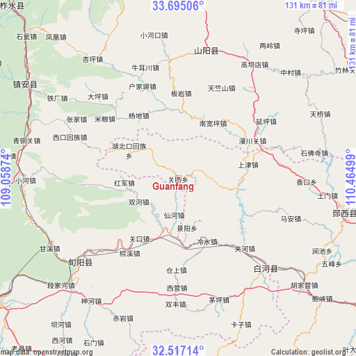
Guanfang GPS coordinates[2]
33° 6' 29.052" North, 109° 45' 42.696" East
| Map corner | latitude | longitude |
|---|---|---|
| Upper-left | 33.69506°, | 109.05874° |
| Center: | 33.10807°, | 109.76186° |
| Lower-right: | 32.51714°, | 110.46499° |
| Map W x H: | 131×131 km | = 81.4×81.4mi |
| max Lat: | 53.31946° ⇑33.4% North |
| Guanfang: | 33.10807° |
| min Lat: | ⇓66.6% South 18.22056° |
| min Long | Guanfang | max Long |
| 75.07348° | 109.76186° | 134.28917° |
| W 27.6%⇐ | ⇒72.4% E |
Elevation
Elevation of Guanfang is 435 m = 1427 ft, and this is 49.8 m = 163 ft below average elevation for this country.
| Max E: |
5622 m = 18445 ft | 28.8% |
| Avg. | 484.8 m = 1591 ft | |
| Guanfang | 435 m = 1427 ft | |
Min E: |
-3 m = -10 ft | 71.2% |
See also: China elevation on elevation.city.
Geographical zone
Guanfang is located in North temperate zone (between Tropic of Cancer and the Arctic Circle). Distance of this Northern Tropic circle is 1075.4 km =668.2 mi to South.| Distance of | km | miles | from Guanfang |
|---|---|---|---|
| North Pole | 6325.8 | 3930.7 | to North |
| Arctic Circle | 3719.9 | 2311.4 | to North |
| Tropic Cancer | 1075.4 | 668.2 | to South |
| Equator | 3681.3 | 2287.5 | to South |


Nearby cities:
15 places around Guanfang: (largest is in red/bold)
• Anjia
70.3 km =43.7 mi,  98°
98°
• Baoxia
69.3 km =43.1 mi,  130°
130°
• Damiao
63.9 km =39.7 mi,  182°
182°
• Guanyin
61 km =37.9 mi,  112°
112°
• Hubeikou
20.8 km =12.9 mi,  299°
299°
• Hujiaying
58.7 km =36.5 mi, 128°
• Jiahe
35.5 km =22.1 mi,  136°
136°
• Jianchi
59.3 km =36.8 mi,  116°
116°
• Jingyang
18.4 km =11.4 mi,  169°
169°
• Ma’an
43.9 km =27.3 mi, 109°
• Shangjin
26.2 km =16.3 mi,  81°
81°
• Wufeng
64.7 km =40.2 mi, 118°
• Yangwei
51.9 km =32.2 mi, 128°
• Yunxixian Chengguanzhen
63.2 km =39.3 mi, 102°
• Zhuping
71.7 km =44.6 mi, 183°
Sources, notices
• [Note1] Compared only with cities in China existing in our database
• [Src1] Map data: © OpenStreetMap contributors (CC-BY-SA)
• [Src2] Other city data from geonames.org with taken over terms of usage.
• [Src3] Geographical zone / Annual Mean Temperature by Robert A. Rohde @ Wikipedia
