Tomorlog geodata
Tomorlog (Qinghai) is a seat of a fourth-order administrative division; located in China in Asia/Shanghai (GMT+8) time zone. In our database, there are 1268 cities with bigger population. Compared to other cities in China, 81.4% of cities are located further ↓South; 97.1% of cities are located further →East and 96.9% of cities have lower elevation than Tomorlog. Note1


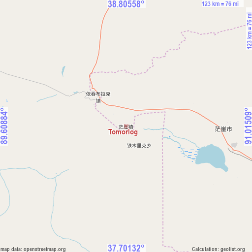
Tomorlog GPS coordinates[2]
38° 15' 19.98" North, 90° 18' 43.056" East
| Map corner | latitude | longitude |
|---|---|---|
| Upper-left | 38.80558°, | 89.60884° |
| Center: | 38.25555°, | 90.31196° |
| Lower-right: | 37.70132°, | 91.01509° |
| Map W x H: | 122.8×122.8 km | = 76.3×76.3mi |
| max Lat: | 53.31946° ⇑18.6% North |
| Tomorlog: | 38.25555° |
| min Lat: | ⇓81.4% South 18.22056° |
| min Long | Tomorlog | max Long |
| 75.07348° | 90.31196° | 134.28917° |
| W 2.9%⇐ | ⇒97.1% E |
Elevation
Elevation of Tomorlog is 3005 m = 9859 ft, and this is 2520.2 m = 8268 ft above average elevation for this country.
| Max E: |
5622 m = 18445 ft | 3.1% |
| Tomorlog | 3005 m 9859 ft | |
| Avg. | 484.8 m = 1591 ft | |
Min E: |
-3 m = -10 ft | 96.9% |
See also: China elevation on elevation.city.
Geographical zone
Tomorlog is located in North temperate zone (between Tropic of Cancer and the Arctic Circle). Distance of this Northern Tropic circle is 1647.7 km =1023.8 mi to South.| Distance of | km | miles | from Tomorlog |
|---|---|---|---|
| North Pole | 5753.4 | 3575 | to North |
| Arctic Circle | 3147.6 | 1955.8 | to North |
| Tropic Cancer | 1647.7 | 1023.8 | to South |
| Equator | 4253.6 | 2643.1 | to South |


Nearby cities:
9 places around Tomorlog: (largest is in red/bold)
• Duobagou
320.4 km =199.1 mi,  58°
58°
• Gasi
53.2 km =33.1 mi,  103°
103°
• Lenghu
268.2 km =166.7 mi,  78°
78°
• Qilanbulak
19.8 km =12.3 mi,  317°
317°
• Qimantage
105.6 km =65.6 mi,  178°
178°
• Ruoqiang
204.9 km =127.3 mi,  294°
294°
• Tieganlike
203.3 km =126.3 mi,  295°
295°
• Waxxari
265.4 km =164.9 mi,  280°
280°
• Wutumeiren
292.3 km =181.6 mi,  120°
120°
Sources, notices
• [Note1] Compared only with cities in China existing in our database
• [Src1] Map data: © OpenStreetMap contributors (CC-BY-SA)
• [Src2] Other city data from geonames.org with taken over terms of usage.
• [Src3] Geographical zone / Annual Mean Temperature by Robert A. Rohde @ Wikipedia
