Lenghu geodata
Lenghu (Qinghai) is a seat of a fourth-order administrative division; located in China in Asia/Shanghai (GMT+8) time zone. In our database, there are 1268 cities with bigger population. Compared to other cities in China, 82.2% of cities are located further ↓South; 96.5% of cities are located further →East and 96.4% of cities have lower elevation than Lenghu. Note1


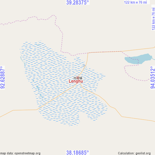
Lenghu GPS coordinates[2]
38° 44' 14.676" North, 93° 19' 55.164" East
| Map corner | latitude | longitude |
|---|---|---|
| Upper-left | 39.28375°, | 92.62887° |
| Center: | 38.73741°, | 93.33199° |
| Lower-right: | 38.18685°, | 94.03512° |
| Map W x H: | 122×122 km | = 75.8×75.8mi |
| max Lat: | 53.31946° ⇑17.8% North |
| Lenghu: | 38.73741° |
| min Lat: | ⇓82.2% South 18.22056° |
| min Long | Lenghu | max Long |
| 75.07348° | 93.33199° | 134.28917° |
| W 3.5%⇐ | ⇒96.5% E |
Elevation
Elevation of Lenghu is 2779 m = 9117 ft, and this is 2294.2 m = 7527 ft above average elevation for this country.
| Max E: |
5622 m = 18445 ft | 3.6% |
| Lenghu | 2779 m 9117 ft | |
| Avg. | 484.8 m = 1591 ft | |
Min E: |
-3 m = -10 ft | 96.4% |
See also: China elevation on elevation.city.
Geographical zone
Lenghu is located in North temperate zone (between Tropic of Cancer and the Arctic Circle). Distance of this Northern Tropic circle is 1701.3 km =1057.1 mi to South.| Distance of | km | miles | from Lenghu |
|---|---|---|---|
| North Pole | 5699.9 | 3541.8 | to North |
| Arctic Circle | 3094 | 1922.5 | to North |
| Tropic Cancer | 1701.3 | 1057.1 | to South |
| Equator | 4307.2 | 2676.4 | to South |


Nearby cities:
15 places around Lenghu: (largest is in red/bold)
• Da Qaidam
199 km =123.7 mi,  120°
120°
• Dangchengwan
170.1 km =105.7 mi,  60°
60°
• Duobagou
113.5 km =70.5 mi,  6°
6°
• Guojiabao
203.6 km =126.5 mi,  37°
37°
• Hongliuwan
131.9 km =82 mi, 41°
• Lüjiabao
199.7 km =124.1 mi, 36°
• Mengjiaqiao
194.7 km =121 mi,  34°
34°
• Qili
188.4 km =117.1 mi, 35°
• Sanwei
196.3 km =122 mi, 36°
• Shazhou
193.1 km =120 mi, 36°
• Suzhou
194.3 km =120.7 mi, 35°
• Wudun
203.4 km =126.4 mi, 38°
• Wutumeiren
203.8 km =126.6 mi,  184°
184°
• Yangjiaqiao
192.1 km =119.4 mi, 36°
• Zhuanqukou
206.9 km =128.6 mi, 35°
Sources, notices
• [Note1] Compared only with cities in China existing in our database
• [Src1] Map data: © OpenStreetMap contributors (CC-BY-SA)
• [Src2] Other city data from geonames.org with taken over terms of usage.
• [Src3] Geographical zone / Annual Mean Temperature by Robert A. Rohde @ Wikipedia
