Nur geodata
Nur (Xinjiang) is a seat of a fourth-order administrative division; located in China in Asia/Urumqi (GMT+6) time zone. In our database, there are 1268 cities with bigger population. Compared to other cities in China, 77.8% of cities are located further ↓South; 99.4% of cities are located further →East and 95% of cities have lower elevation than Nur. Note1


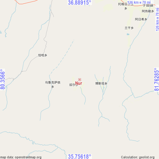
Nur GPS coordinates[2]
36° 19' 28.992" North, 81° 3' 34.992" East
| Map corner | latitude | longitude |
|---|---|---|
| Upper-left | 36.88915°, | 80.3566° |
| Center: | 36.32472°, | 81.05972° |
| Lower-right: | 35.75618°, | 81.76285° |
| Map W x H: | 126×126 km | = 78.3×78.3mi |
| max Lat: | 53.31946° ⇑22.2% North |
| Nur: | 36.32472° |
| min Lat: | ⇓77.8% South 18.22056° |
| min Long | Nur | max Long |
| 75.07348° | 81.05972° | 134.28917° |
| W 0.6%⇐ | ⇒99.4% E |
Elevation
Elevation of Nur is 2126 m = 6975 ft, and this is 1641.2 m = 5385 ft above average elevation for this country.
| Max E: |
5622 m = 18445 ft | 5% |
| Nur | 2126 m 6975 ft | |
| Avg. | 484.8 m = 1591 ft | |
Min E: |
-3 m = -10 ft | 95% |
See also: China elevation on elevation.city.
Geographical zone
Nur is located in North temperate zone (between Tropic of Cancer and the Arctic Circle). Distance of this Northern Tropic circle is 1433 km =890.4 mi to South.| Distance of | km | miles | from Nur |
|---|---|---|---|
| North Pole | 5968.1 | 3708.4 | to North |
| Arctic Circle | 3362.2 | 2089.2 | to North |
| Tropic Cancer | 1433 | 890.4 | to South |
| Equator | 4038.9 | 2509.7 | to South |


Nearby cities:
15 places around Nur: (largest is in red/bold)
• Aqqan
82.7 km =51.4 mi,  78°
78°
• Damiku
72.8 km =45.2 mi,  2°
2°
• Hotan
132.7 km =82.5 mi,  310°
310°
• Karakax
158 km =98.2 mi, 311°
• Layka
145 km =90.1 mi, 305°
• Lop
114.3 km =71 mi,  316°
316°
• Mugala
80.4 km =50 mi,  42°
42°
• Niya
167 km =103.8 mi,  60°
60°
• Nu’erbage
134.8 km =83.8 mi, 310°
• Oytograk
96.3 km =59.8 mi,  54°
54°
• Qira
81.5 km =50.6 mi,  343°
343°
• Rokiya
177.5 km =110.3 mi, 61°
• Xambabazar
74.3 km =46.2 mi,  32°
32°
• Yeyik
198 km =123 mi, 78°
• Zangguy
230.3 km =143.1 mi,  297°
297°
Sources, notices
• [Note1] Compared only with cities in China existing in our database
• [Src1] Map data: © OpenStreetMap contributors (CC-BY-SA)
• [Src2] Other city data from geonames.org with taken over terms of usage.
• [Src3] Geographical zone / Annual Mean Temperature by Robert A. Rohde @ Wikipedia
