Yanchiwan geodata
Yanchiwan (Gansu) is a seat of a fourth-order administrative division; located in China in Asia/Urumqi (GMT+6) time zone. In our database, there are 1268 cities with bigger population. Compared to other cities in China, 82.7% of cities are located further ↓South; 95.8% of cities are located further →East and 97.3% of cities have lower elevation than Yanchiwan. Note1


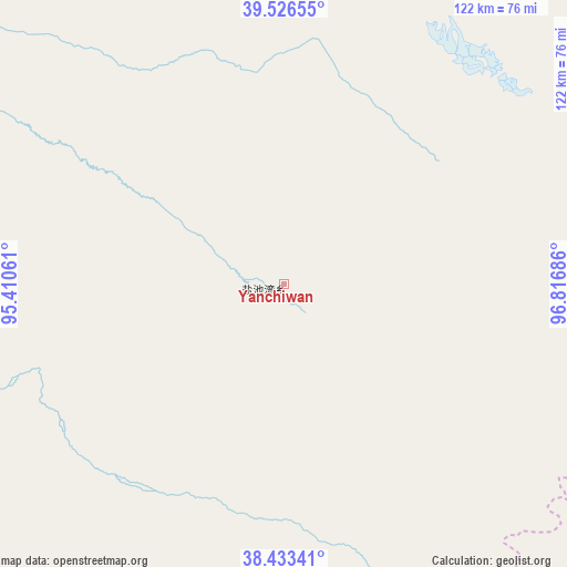
Yanchiwan GPS coordinates[2]
38° 58' 55.524" North, 96° 6' 49.428" East
| Map corner | latitude | longitude |
|---|---|---|
| Upper-left | 39.52655°, | 95.41061° |
| Center: | 38.98209°, | 96.11373° |
| Lower-right: | 38.43341°, | 96.81686° |
| Map W x H: | 121.5×121.5 km | = 75.5×75.5mi |
| max Lat: | 53.31946° ⇑17.3% North |
| Yanchiwan: | 38.98209° |
| min Lat: | ⇓82.7% South 18.22056° |
| min Long | Yanchiwan | max Long |
| 75.07348° | 96.11373° | 134.28917° |
| W 4.2%⇐ | ⇒95.8% E |
Elevation
Elevation of Yanchiwan is 3268 m = 10722 ft, and this is 2783.2 m = 9131 ft above average elevation for this country.
| Max E: |
5622 m = 18445 ft | 2.7% |
| Yanchiwan | 3268 m 10722 ft | |
| Avg. | 484.8 m = 1591 ft | |
Min E: |
-3 m = -10 ft | 97.3% |
See also: China elevation on elevation.city.
Geographical zone
Yanchiwan is located in North temperate zone (between Tropic of Cancer and the Arctic Circle). Distance of this Northern Tropic circle is 1728.5 km =1074 mi to South.| Distance of | km | miles | from Yanchiwan |
|---|---|---|---|
| North Pole | 5672.7 | 3524.9 | to North |
| Arctic Circle | 3066.8 | 1905.6 | to North |
| Tropic Cancer | 1728.5 | 1074 | to South |
| Equator | 4334.4 | 2693.3 | to South |


Nearby cities:
15 places around Yanchiwan: (largest is in red/bold)
• Changma
113.2 km =70.3 mi,  29°
29°
• Chijin
160.7 km =99.9 mi,  44°
44°
• Da Qaidam
146.1 km =90.8 mi,  209°
209°
• Dangchengwan
108.9 km =67.7 mi,  301°
301°
• Dongbatu
125.1 km =77.7 mi,  343°
343°
• Gahe
133.1 km =82.7 mi,  98°
98°
• Guazhou
169 km =105 mi,  347°
347°
• Hongliuwan
169.1 km =105.1 mi, 295°
• Laojunmiao
168.3 km =104.6 mi,  55°
55°
• Nancha
163.4 km =101.5 mi, 346°
• Qiaozi
149.4 km =92.8 mi,  2°
2°
• Qiqing
164.3 km =102.1 mi,  82°
82°
• Shibaocheng
91 km =56.5 mi,  357°
357°
• Tashi
142.8 km =88.7 mi, 355°
• Yu’erhong
122.8 km =76.3 mi,  49°
49°
Sources, notices
• [Note1] Compared only with cities in China existing in our database
• [Src1] Map data: © OpenStreetMap contributors (CC-BY-SA)
• [Src2] Other city data from geonames.org with taken over terms of usage.
• [Src3] Geographical zone / Annual Mean Temperature by Robert A. Rohde @ Wikipedia
