Xinhe geodata
Xinhe (Xinjiang) is a seat of a third-order administrative division; located in China in Asia/Urumqi (GMT+6) time zone. In our database, there are 1268 cities with bigger population. Compared to other cities in China, 90.2% of cities are located further ↓South; 99.1% of cities are located further →East and 85.5% of cities have lower elevation than Xinhe. Note1


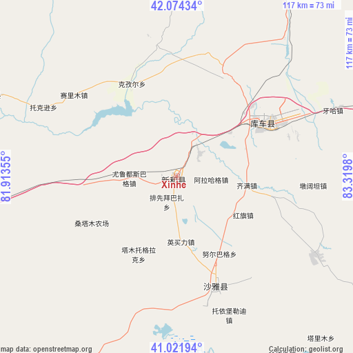
Xinhe GPS coordinates[2]
41° 33' 1.008" North, 82° 37' 0.012" East
| Map corner | latitude | longitude |
|---|---|---|
| Upper-left | 42.07434°, | 81.91355° |
| Center: | 41.55028°, | 82.61667° |
| Lower-right: | 41.02194°, | 83.3198° |
| Map W x H: | 117×117 km | = 72.7×72.7mi |
| max Lat: | 53.31946° ⇑9.8% North |
| Xinhe: | 41.55028° |
| min Lat: | ⇓90.2% South 18.22056° |
| min Long | Xinhe | max Long |
| 75.07348° | 82.61667° | 134.28917° |
| W 0.9%⇐ | ⇒99.1% E |
Elevation
Elevation of Xinhe is 1014 m = 3327 ft, and this is 529.2 m = 1736 ft above average elevation for this country.
| Max E: |
5622 m = 18445 ft | 14.5% |
| Xinhe | 1014 m 3327 ft | |
| Avg. | 484.8 m = 1591 ft | |
Min E: |
-3 m = -10 ft | 85.5% |
See also: China elevation on elevation.city.
Geographical zone
Xinhe is located in North temperate zone (between Tropic of Cancer and the Arctic Circle). Distance of this Northern Tropic circle is 2014 km =1251.4 mi to South.| Distance of | km | miles | from Xinhe |
|---|---|---|---|
| North Pole | 5387.1 | 3347.4 | to North |
| Arctic Circle | 2781.2 | 1728.2 | to North |
| Tropic Cancer | 2014 | 1251.4 | to South |
| Equator | 4620 | 2870.7 | to South |


Nearby cities:
15 places around Xinhe: (largest is in red/bold)
• Alakaga
12.5 km =7.8 mi,  91°
91°
• Baicheng
66.9 km =41.6 mi,  291°
291°
• Daqiao
88.7 km =55.1 mi,  275°
275°
• Hongqi
23.6 km =14.7 mi,  120°
120°
• Keyi
67.9 km =42.2 mi,  1°
1°
• Kizil
33.6 km =20.9 mi,  333°
333°
• Kuqa
32 km =19.9 mi,  54°
54°
• Payxambabazar
11.6 km =7.2 mi,  196°
196°
• Qarqi
104.1 km =64.7 mi,  272°
272°
• Qiman
24.6 km =15.3 mi, 93°
• Sairam
45.8 km =28.5 mi,  301°
301°
• Tamutuo Gelake
28.1 km =17.5 mi,  213°
213°
• Xayar
39 km =24.2 mi,  156°
156°
• Yengimahalla
22.8 km =14.2 mi,  172°
172°
• Youludu Sibage
18.7 km =11.6 mi, 270°
Sources, notices
• [Note1] Compared only with cities in China existing in our database
• [Src1] Map data: © OpenStreetMap contributors (CC-BY-SA)
• [Src2] Other city data from geonames.org with taken over terms of usage.
• [Src3] Geographical zone / Annual Mean Temperature by Robert A. Rohde @ Wikipedia
