Keyi geodata
Keyi (Xinjiang) is a seat of a fourth-order administrative division; located in China in Asia/Urumqi (GMT+6) time zone. In our database, there are 1268 cities with bigger population. Compared to other cities in China, 91.1% of cities are located further ↓South; 99% of cities are located further →East and 92.2% of cities have lower elevation than Keyi. Note1


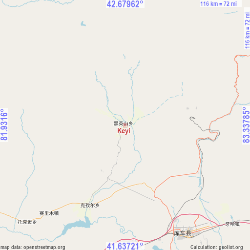
Keyi GPS coordinates[2]
42° 9' 38.016" North, 82° 38' 4.992" East
| Map corner | latitude | longitude |
|---|---|---|
| Upper-left | 42.67962°, | 81.9316° |
| Center: | 42.16056°, | 82.63472° |
| Lower-right: | 41.63721°, | 83.33785° |
| Map W x H: | 115.9×115.9 km | = 72×72mi |
| max Lat: | 53.31946° ⇑8.9% North |
| Keyi: | 42.16056° |
| min Lat: | ⇓91.1% South 18.22056° |
| min Long | Keyi | max Long |
| 75.07348° | 82.63472° | 134.28917° |
| W 1%⇐ | ⇒99% E |
Elevation
Elevation of Keyi is 1600 m = 5249 ft, and this is 1115.2 m = 3659 ft above average elevation for this country.
| Max E: |
5622 m = 18445 ft | 7.8% |
| Keyi | 1600 m 5249 ft | |
| Avg. | 484.8 m = 1591 ft | |
Min E: |
-3 m = -10 ft | 92.2% |
See also: China elevation on elevation.city.
Geographical zone
Keyi is located in North temperate zone (between Tropic of Cancer and the Arctic Circle). Distance of this Northern Tropic circle is 2081.9 km =1293.6 mi to South.| Distance of | km | miles | from Keyi |
|---|---|---|---|
| North Pole | 5319.2 | 3305.2 | to North |
| Arctic Circle | 2713.4 | 1686 | to North |
| Tropic Cancer | 2081.9 | 1293.6 | to South |
| Equator | 4687.8 | 2912.9 | to South |


Nearby cities:
15 places around Keyi: (largest is in red/bold)
• Alakaga
69.1 km =42.9 mi,  170°
170°
• Baicheng
76.5 km =47.5 mi,  235°
235°
• Daqiao
107 km =66.5 mi, 236°
• Hongqi
82 km =51 mi, 166°
• Kizil
41.3 km =25.7 mi,  203°
203°
• Kuqa
55.1 km =34.2 mi,  153°
153°
• Muhur
115.6 km =71.8 mi,  359°
359°
• Payxambabazar
79.1 km =49.2 mi,  183°
183°
• Qiman
72.9 km =45.3 mi,  161°
161°
• Sairam
59.6 km =37 mi,  222°
222°
• Tamutuo Gelake
92.8 km =57.7 mi,  190°
190°
• Xayar
104.4 km =64.9 mi, 172°
• Xinhe
67.9 km =42.2 mi, 181°
• Yengimahalla
90.5 km =56.2 mi, 179°
• Youludu Sibage
70.5 km =43.8 mi, 196°
Sources, notices
• [Note1] Compared only with cities in China existing in our database
• [Src1] Map data: © OpenStreetMap contributors (CC-BY-SA)
• [Src2] Other city data from geonames.org with taken over terms of usage.
• [Src3] Geographical zone / Annual Mean Temperature by Robert A. Rohde @ Wikipedia
