Kupu geodata
Kupu (Xinjiang) is a seat of a fourth-order administrative division; located in China in Asia/Urumqi (GMT+6) time zone. In our database, there are 1268 cities with bigger population. Compared to other cities in China, 94.8% of cities are located further ↓South; 98.9% of cities are located further →East and 91.1% of cities have lower elevation than Kupu. Note1


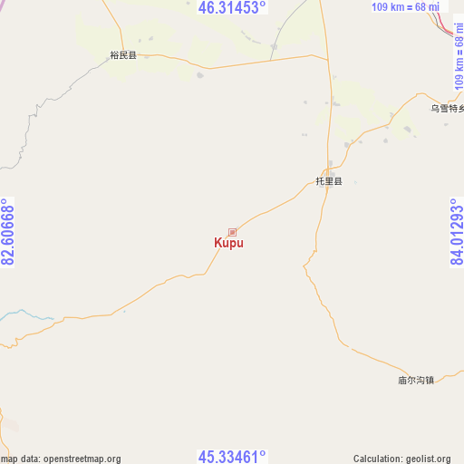
Kupu GPS coordinates[2]
45° 49' 36.228" North, 83° 18' 35.28" East
| Map corner | latitude | longitude |
|---|---|---|
| Upper-left | 46.31453°, | 82.60668° |
| Center: | 45.82673°, | 83.3098° |
| Lower-right: | 45.33461°, | 84.01293° |
| Map W x H: | 109×109 km | = 67.7×67.7mi |
| max Lat: | 53.31946° ⇑5.2% North |
| Kupu: | 45.82673° |
| min Lat: | ⇓94.8% South 18.22056° |
| min Long | Kupu | max Long |
| 75.07348° | 83.3098° | 134.28917° |
| W 1.1%⇐ | ⇒98.9% E |
Elevation
Elevation of Kupu is 1467 m = 4813 ft, and this is 982.2 m = 3222 ft above average elevation for this country.
| Max E: |
5622 m = 18445 ft | 8.9% |
| Kupu | 1467 m 4813 ft | |
| Avg. | 484.8 m = 1591 ft | |
Min E: |
-3 m = -10 ft | 91.1% |
See also: China elevation on elevation.city.
Geographical zone
Kupu is located in North temperate zone (between Tropic of Cancer and the Arctic Circle). Distance of this North polar circle is 2305.7 km =1432.7 mi to North.| Distance of | km | miles | from Kupu |
|---|---|---|---|
| North Pole | 4911.6 | 3051.9 | to North |
| Arctic Circle | 2305.7 | 1432.7 | to North |
| Tropic Cancer | 2489.5 | 1546.9 | to South |
| Equator | 5095.5 | 3166.2 | to South |


Nearby cities:
15 places around Kupu: (largest is in red/bold)
• Akebielidou
44.4 km =27.6 mi,  12°
12°
• Altunemil
36.7 km =22.8 mi,  332°
332°
• Dolati
33.7 km =20.9 mi,  52°
52°
• Emil
93 km =57.8 mi,  348°
348°
• Emin
81.6 km =50.7 mi,  17°
17°
• Erdaoqiao
65.9 km =40.9 mi, 16°
• Hujirti Mongolzuxiang
72.8 km =45.2 mi,  33°
33°
• Jiaoqu
82.5 km =51.3 mi, 17°
• Lamazhao
93 km =57.8 mi,  59°
59°
• Marelesu
77.4 km =48.1 mi, 23°
• Miao’ergou
55.2 km =34.3 mi,  128°
128°
• Qaxa
96.1 km =59.7 mi,  4°
4°
• Tiechanggou
94.3 km =58.6 mi,  66°
66°
• Toli
25.7 km =16 mi, 61°
• Wuxuete
58.3 km =36.2 mi, 59°
Sources, notices
• [Note1] Compared only with cities in China existing in our database
• [Src1] Map data: © OpenStreetMap contributors (CC-BY-SA)
• [Src2] Other city data from geonames.org with taken over terms of usage.
• [Src3] Geographical zone / Annual Mean Temperature by Robert A. Rohde @ Wikipedia
