Lamazhao geodata
Lamazhao (Heilongjiang) is a seat of a fourth-order administrative division; located in China in Asia/Urumqi (GMT+6) time zone. In our database, there are 1268 cities with bigger population. Compared to other cities in China, 95.4% of cities are located further ↓South; 98.7% of cities are located further →East and 82.8% of cities have lower elevation than Lamazhao. Note1


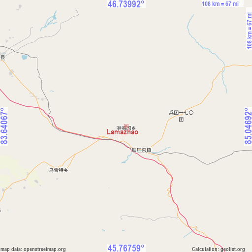
Lamazhao GPS coordinates[2]
46° 15' 21.276" North, 84° 20' 37.644" East
| Map corner | latitude | longitude |
|---|---|---|
| Upper-left | 46.73992°, | 83.64067° |
| Center: | 46.25591°, | 84.34379° |
| Lower-right: | 45.76759°, | 85.04692° |
| Map W x H: | 108.1×108.1 km | = 67.2×67.2mi |
| max Lat: | 53.31946° ⇑4.6% North |
| Lamazhao: | 46.25591° |
| min Lat: | ⇓95.4% South 18.22056° |
| min Long | Lamazhao | max Long |
| 75.07348° | 84.34379° | 134.28917° |
| W 1.3%⇐ | ⇒98.7% E |
Elevation
Elevation of Lamazhao is 838 m = 2749 ft, and this is 353.2 m = 1159 ft above average elevation for this country.
| Max E: |
5622 m = 18445 ft | 17.2% |
| Lamazhao | 838 m 2749 ft | |
| Avg. | 484.8 m = 1591 ft | |
Min E: |
-3 m = -10 ft | 82.8% |
See also: China elevation on elevation.city.
Geographical zone
Lamazhao is located in North temperate zone (between Tropic of Cancer and the Arctic Circle). Distance of this North polar circle is 2258 km =1403.1 mi to North.| Distance of | km | miles | from Lamazhao |
|---|---|---|---|
| North Pole | 4863.9 | 3022.3 | to North |
| Arctic Circle | 2258 | 1403.1 | to North |
| Tropic Cancer | 2537.3 | 1576.6 | to South |
| Equator | 5143.2 | 3195.8 | to South |


Nearby cities:
15 places around Lamazhao: (largest is in red/bold)
• Akebielidou
70.2 km =43.6 mi,  266°
266°
• Dolati
59.6 km =37 mi,  242°
242°
• Emalgolin Mongolzuxiang
52.8 km =32.8 mi,  330°
330°
• Emin
62.2 km =38.6 mi,  298°
298°
• Erdaoqiao
62.3 km =38.7 mi,  284°
284°
• Hujirti Mongolzuxiang
40.9 km =25.4 mi,  288°
288°
• Jelagax
50.3 km =31.3 mi,  319°
319°
• Jiaoqu
63 km =39.1 mi, 299°
• Kalayemule
55.5 km =34.5 mi,  1°
1°
• Marelesu
54.5 km =33.9 mi, 295°
• Shanghu
58.2 km =36.2 mi, 316°
• Tiechanggou
11.9 km =7.4 mi,  146°
146°
• Toli
67.3 km =41.8 mi, 238°
• Wuxuete
34.7 km =21.6 mi, 238°
• Yushikalasu
55.4 km =34.4 mi,  335°
335°
Sources, notices
• [Note1] Compared only with cities in China existing in our database
• [Src1] Map data: © OpenStreetMap contributors (CC-BY-SA)
• [Src2] Other city data from geonames.org with taken over terms of usage.
• [Src3] Geographical zone / Annual Mean Temperature by Robert A. Rohde @ Wikipedia
