Halajun geodata
Halajun (Xinjiang) is a seat of a fourth-order administrative division; located in China in Asia/Urumqi (GMT+6) time zone. In our database, there are 1268 cities with bigger population. Compared to other cities in China, 87.4% of cities are located further ↓South; 99.8% of cities are located further →East and 93.3% of cities have lower elevation than Halajun. Note1


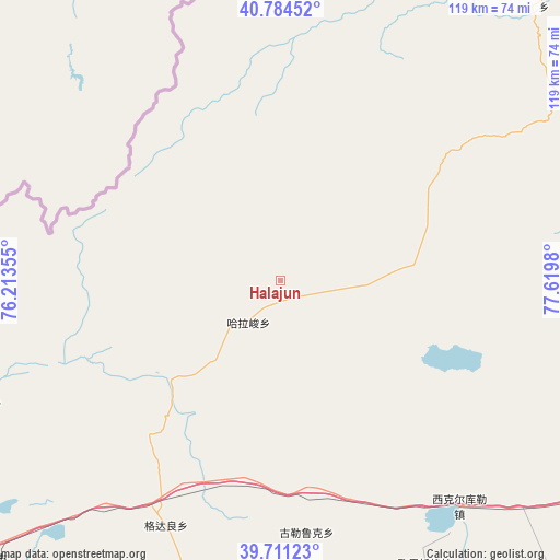
Halajun GPS coordinates[2]
40° 15' 0" North, 76° 55' 0.012" East
| Map corner | latitude | longitude |
|---|---|---|
| Upper-left | 40.78452°, | 76.21355° |
| Center: | 40.25°, | 76.91667° |
| Lower-right: | 39.71123°, | 77.6198° |
| Map W x H: | 119.3×119.3 km | = 74.1×74.1mi |
| max Lat: | 53.31946° ⇑12.6% North |
| Halajun: | 40.25° |
| min Lat: | ⇓87.4% South 18.22056° |
| min Long | Halajun | max Long |
| 75.07348° | 76.91667° | 134.28917° |
| W 0.2%⇐ | ⇒99.8% E |
Elevation
Elevation of Halajun is 1750 m = 5741 ft, and this is 1265.2 m = 4151 ft above average elevation for this country.
| Max E: |
5622 m = 18445 ft | 6.7% |
| Halajun | 1750 m 5741 ft | |
| Avg. | 484.8 m = 1591 ft | |
Min E: |
-3 m = -10 ft | 93.3% |
See also: China elevation on elevation.city.
Geographical zone
Halajun is located in North temperate zone (between Tropic of Cancer and the Arctic Circle). Distance of this Northern Tropic circle is 1869.5 km =1161.7 mi to South.| Distance of | km | miles | from Halajun |
|---|---|---|---|
| North Pole | 5531.7 | 3437.2 | to North |
| Arctic Circle | 2925.8 | 1818 | to North |
| Tropic Cancer | 1869.5 | 1161.7 | to South |
| Equator | 4475.4 | 2780.9 | to South |


Nearby cities:
15 places around Halajun: (largest is in red/bold)
• Arzak
93.2 km =57.9 mi,  226°
226°
• Gedaliang
58.1 km =36.1 mi,  203°
203°
• Guleluke
53.2 km =33.1 mi,  174°
174°
• Hexia’awati
70.9 km =44.1 mi,  188°
188°
• Jiangbazi
91.1 km =56.6 mi, 191°
• Jiashi
85.2 km =52.9 mi, 190°
• Karabulak
75.2 km =46.7 mi,  44°
44°
• Kezileboyi
101.2 km =62.9 mi, 198°
• Kizilsu
65.7 km =40.8 mi, 193°
• Tierimu
83.7 km =52 mi, 190°
• Wolituogelake
69.3 km =43.1 mi,  153°
153°
• Xekar
61.6 km =38.3 mi,  141°
141°
• Xiaputule
90.6 km =56.3 mi, 196°
• Yingmaili
82.8 km =51.4 mi, 186°
• Yudaikelike
92.6 km =57.5 mi,  130°
130°
Sources, notices
• [Note1] Compared only with cities in China existing in our database
• [Src1] Map data: © OpenStreetMap contributors (CC-BY-SA)
• [Src2] Other city data from geonames.org with taken over terms of usage.
• [Src3] Geographical zone / Annual Mean Temperature by Robert A. Rohde @ Wikipedia
