Arzak geodata
Arzak (Xinjiang) is a seat of a fourth-order administrative division; located in China in Asia/Urumqi (GMT+6) time zone. In our database, there are 1268 cities with bigger population. Compared to other cities in China, 85.2% of cities are located further ↓South; 99.9% of cities are located further →East and 89.4% of cities have lower elevation than Arzak. Note1


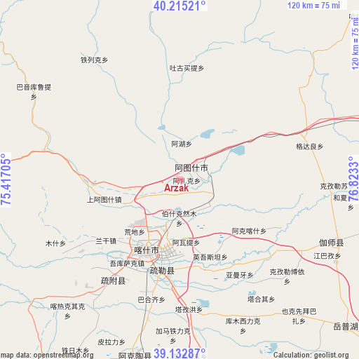
Arzak GPS coordinates[2]
39° 40' 34.176" North, 76° 7' 12.612" East
| Map corner | latitude | longitude |
|---|---|---|
| Upper-left | 40.21521°, | 75.41705° |
| Center: | 39.67616°, | 76.12017° |
| Lower-right: | 39.13287°, | 76.8233° |
| Map W x H: | 120.3×120.3 km | = 74.8×74.8mi |
| max Lat: | 53.31946° ⇑14.8% North |
| Arzak: | 39.67616° |
| min Lat: | ⇓85.2% South 18.22056° |
| min Long | Arzak | max Long |
| 75.07348° | 76.12017° | 134.28917° |
| W 0.1%⇐ | ⇒99.9% E |
Elevation
Elevation of Arzak is 1304 m = 4278 ft, and this is 819.2 m = 2688 ft above average elevation for this country.
| Max E: |
5622 m = 18445 ft | 10.6% |
| Arzak | 1304 m 4278 ft | |
| Avg. | 484.8 m = 1591 ft | |
Min E: |
-3 m = -10 ft | 89.4% |
See also: China elevation on elevation.city.
Geographical zone
Arzak is located in North temperate zone (between Tropic of Cancer and the Arctic Circle). Distance of this Northern Tropic circle is 1805.7 km =1122 mi to South.| Distance of | km | miles | from Arzak |
|---|---|---|---|
| North Pole | 5595.5 | 3476.9 | to North |
| Arctic Circle | 2989.6 | 1857.7 | to North |
| Tropic Cancer | 1805.7 | 1122 | to South |
| Equator | 4411.6 | 2741.2 | to South |


Nearby cities:
15 places around Arzak: (largest is in red/bold)
• Aiximan
55.8 km =34.7 mi,  142°
142°
• Aqqik
72.5 km =45 mi,  147°
147°
• Gedaliang
46.3 km =28.8 mi,  77°
77°
• Hexia’awati
57.8 km =35.9 mi,  96°
96°
• Jiangbazi
56.1 km =34.9 mi,  117°
117°
• Jiashi
57 km =35.4 mi,  110°
110°
• Kashgar
25.4 km =15.8 mi,  206°
206°
• Kezileboyi
48.8 km =30.3 mi,  131°
131°
• Kizilsu
53 km =32.9 mi,  90°
90°
• Seyeke
69.6 km =43.2 mi, 137°
• Shule
31 km =19.3 mi,  191°
191°
• Tierimu
55.6 km =34.5 mi, 109°
• Xiaputule
48.5 km =30.1 mi, 118°
• Yekexianbaibazha
59.9 km =37.2 mi, 138°
• Yingmaili
61.2 km =38 mi, 107°
Sources, notices
• [Note1] Compared only with cities in China existing in our database
• [Src1] Map data: © OpenStreetMap contributors (CC-BY-SA)
• [Src2] Other city data from geonames.org with taken over terms of usage.
• [Src3] Geographical zone / Annual Mean Temperature by Robert A. Rohde @ Wikipedia
