Aqal geodata
Aqal (Xinjiang) is a seat of a fourth-order administrative division; located in China in Asia/Urumqi (GMT+6) time zone. In our database, there are 1268 cities with bigger population. Compared to other cities in China, 87.9% of cities are located further ↓South; 99.6% of cities are located further →East and 86.6% of cities have lower elevation than Aqal. Note1


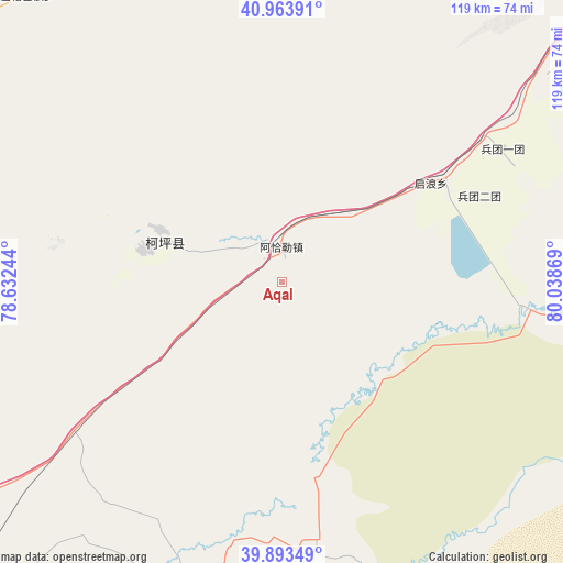
Aqal GPS coordinates[2]
40° 25' 50.988" North, 79° 20' 8.016" East
| Map corner | latitude | longitude |
|---|---|---|
| Upper-left | 40.96391°, | 78.63244° |
| Center: | 40.43083°, | 79.33556° |
| Lower-right: | 39.89349°, | 80.03869° |
| Map W x H: | 119×119 km | = 73.9×73.9mi |
| max Lat: | 53.31946° ⇑12.1% North |
| Aqal: | 40.43083° |
| min Lat: | ⇓87.9% South 18.22056° |
| min Long | Aqal | max Long |
| 75.07348° | 79.33556° | 134.28917° |
| W 0.4%⇐ | ⇒99.6% E |
Elevation
Elevation of Aqal is 1085 m = 3560 ft, and this is 600.2 m = 1969 ft above average elevation for this country.
| Max E: |
5622 m = 18445 ft | 13.4% |
| Aqal | 1085 m 3560 ft | |
| Avg. | 484.8 m = 1591 ft | |
Min E: |
-3 m = -10 ft | 86.6% |
See also: China elevation on elevation.city.
Geographical zone
Aqal is located in North temperate zone (between Tropic of Cancer and the Arctic Circle). Distance of this Northern Tropic circle is 1889.6 km =1174.1 mi to South.| Distance of | km | miles | from Aqal |
|---|---|---|---|
| North Pole | 5511.6 | 3424.7 | to North |
| Arctic Circle | 2905.7 | 1805.5 | to North |
| Tropic Cancer | 1889.6 | 1174.1 | to South |
| Equator | 4495.5 | 2793.4 | to South |


Nearby cities:
15 places around Aqal: (largest is in red/bold)
• Akqi
94.2 km =58.5 mi,  307°
307°
• Aksu
115.4 km =71.7 mi,  43°
43°
• Awat
91.2 km =56.7 mi,  75°
75°
• Aykol
89.3 km =55.5 mi,  49°
49°
• Kalpin
25.2 km =15.7 mi,  295°
295°
• Qilan
28.2 km =17.5 mi,  57°
57°
• Saparbay
74.9 km =46.5 mi,  316°
316°
• Tumxuk
66.6 km =41.4 mi,  200°
200°
• Tumxuk
116.8 km =72.6 mi,  26°
26°
• Wensu
120.6 km =74.9 mi, 39°
• Wuluquele
97.2 km =60.4 mi,  88°
88°
• Wushi
80.7 km =50.1 mi,  353°
353°
• Yamansu
82.6 km =51.3 mi, 345°
• Yengiawat
103.1 km =64.1 mi,  6°
6°
• Yimamu
86.6 km =53.8 mi, 6°
Sources, notices
• [Note1] Compared only with cities in China existing in our database
• [Src1] Map data: © OpenStreetMap contributors (CC-BY-SA)
• [Src2] Other city data from geonames.org with taken over terms of usage.
• [Src3] Geographical zone / Annual Mean Temperature by Robert A. Rohde @ Wikipedia
