Yamansu geodata
Yamansu (Xinjiang) is a seat of a fourth-order administrative division; located in China in Asia/Urumqi (GMT+6) time zone. In our database, there are 1268 cities with bigger population. Compared to other cities in China, 89.5% of cities are located further ↓South; 99.6% of cities are located further →East and 91.5% of cities have lower elevation than Yamansu. Note1


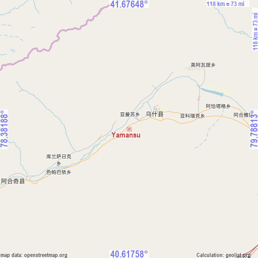
Yamansu GPS coordinates[2]
41° 8' 57.012" North, 79° 5' 6" East
| Map corner | latitude | longitude |
|---|---|---|
| Upper-left | 41.67648°, | 78.38188° |
| Center: | 41.14917°, | 79.085° |
| Lower-right: | 40.61758°, | 79.78813° |
| Map W x H: | 117.7×117.7 km | = 73.1×73.1mi |
| max Lat: | 53.31946° ⇑10.5% North |
| Yamansu: | 41.14917° |
| min Lat: | ⇓89.5% South 18.22056° |
| min Long | Yamansu | max Long |
| 75.07348° | 79.085° | 134.28917° |
| W 0.4%⇐ | ⇒99.6% E |
Elevation
Elevation of Yamansu is 1522 m = 4993 ft, and this is 1037.2 m = 3403 ft above average elevation for this country.
| Max E: |
5622 m = 18445 ft | 8.5% |
| Yamansu | 1522 m 4993 ft | |
| Avg. | 484.8 m = 1591 ft | |
Min E: |
-3 m = -10 ft | 91.5% |
See also: China elevation on elevation.city.
Geographical zone
Yamansu is located in North temperate zone (between Tropic of Cancer and the Arctic Circle). Distance of this Northern Tropic circle is 1969.4 km =1223.7 mi to South.| Distance of | km | miles | from Yamansu |
|---|---|---|---|
| North Pole | 5431.7 | 3375.1 | to North |
| Arctic Circle | 2825.8 | 1755.9 | to North |
| Tropic Cancer | 1969.4 | 1223.7 | to South |
| Equator | 4575.4 | 2843 | to South |


Nearby cities:
15 places around Yamansu: (largest is in red/bold)
• Akqi
58.5 km =36.4 mi,  246°
246°
• Aksu
100 km =62.1 mi,  87°
87°
• Aqal
82.6 km =51.3 mi,  165°
165°
• Awat
122.7 km =76.2 mi,  117°
117°
• Aykol
90.6 km =56.3 mi,  103°
103°
• Jiamu
124.1 km =77.1 mi,  83°
83°
• Kalpin
69.1 km =42.9 mi,  181°
181°
• Kizil
120.3 km =74.8 mi, 93°
• Qilan
78.7 km =48.9 mi,  145°
145°
• Saparbay
39.7 km =24.7 mi,  229°
229°
• Tumxuk
77.3 km =48 mi,  71°
71°
• Wensu
97.6 km =60.6 mi, 81°
• Wushi
11.7 km =7.3 mi, 88°
• Yengiawat
39.2 km =24.4 mi,  54°
54°
• Yimamu
31.8 km =19.8 mi, 78°
Sources, notices
• [Note1] Compared only with cities in China existing in our database
• [Src1] Map data: © OpenStreetMap contributors (CC-BY-SA)
• [Src2] Other city data from geonames.org with taken over terms of usage.
• [Src3] Geographical zone / Annual Mean Temperature by Robert A. Rohde @ Wikipedia
