Taifeng geodata
Taifeng (Anhui) is a seat of a fourth-order administrative division; located in China in Asia/Shanghai (GMT+8) time zone. In our database, there are 1268 cities with bigger population. Compared to other cities in China, 55.3% of cities are located further ↓South; 72.9% of cities are located further ←West and 95.9% of cities have higher elevation than Taifeng. Note1


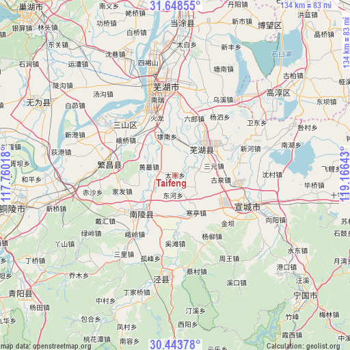
Taifeng GPS coordinates[2]
31° 2' 53.052" North, 118° 27' 47.88" East
| Map corner | latitude | longitude |
|---|---|---|
| Upper-left | 31.64855°, | 117.76018° |
| Center: | 31.04807°, | 118.4633° |
| Lower-right: | 30.44378°, | 119.16643° |
| Map W x H: | 134×134 km | = 83.3×83.3mi |
| max Lat: | 53.31946° ⇑44.7% North |
| Taifeng: | 31.04807° |
| min Lat: | ⇓55.3% South 18.22056° |
| min Long | Taifeng | max Long |
| 75.07348° | 118.4633° | 134.28917° |
| W 72.9%⇐ | ⇒27.1% E |
Elevation
Elevation of Taifeng is 6 m = 20 ft, and this is 478.8 m = 1571 ft below average elevation for this country.
| Max E: |
5622 m = 18445 ft | 95.9% |
| Avg. | 484.8 m = 1591 ft | |
| Taifeng | 6 m = 20 ft | |
Min E: |
-3 m = -10 ft | 4.1% |
See also: China elevation on elevation.city.
Geographical zone
Taifeng is located in North temperate zone (between Tropic of Cancer and the Arctic Circle). Distance of this Northern Tropic circle is 846.3 km =525.9 mi to South.| Distance of | km | miles | from Taifeng |
|---|---|---|---|
| North Pole | 6554.8 | 4073 | to North |
| Arctic Circle | 3949 | 2453.8 | to North |
| Tropic Cancer | 846.3 | 525.9 | to South |
| Equator | 3452.2 | 2145.1 | to South |


Nearby cities:
15 places around Taifeng: (largest is in red/bold)
• Dainan
15.1 km =9.4 mi,  348°
348°
• Donghe
7.7 km =4.8 mi,  185°
185°
• Huangmu
10.5 km =6.5 mi,  288°
288°
• Jiulian
12.9 km =8 mi,  216°
216°
• Kuihu
12.5 km =7.8 mi,  335°
335°
• Pingpu
14.1 km =8.8 mi,  252°
252°
• Sanyuan
15.3 km =9.5 mi,  76°
76°
• Taoxin
12.7 km =7.9 mi,  9°
9°
• Wanzhi
14.8 km =9.2 mi,  41°
41°
• Wenchang
16.2 km =10.1 mi,  171°
171°
• Wuhu
14.6 km =9.1 mi, 41°
• Xihe
6.4 km =4 mi, 170°
• Xuzhen
5.9 km =3.7 mi, 286°
• Yijiang
15.8 km =9.8 mi, 172°
• Zhougao
16.1 km =10 mi,  29°
29°
Sources, notices
• [Note1] Compared only with cities in China existing in our database
• [Src1] Map data: © OpenStreetMap contributors (CC-BY-SA)
• [Src2] Other city data from geonames.org with taken over terms of usage.
• [Src3] Geographical zone / Annual Mean Temperature by Robert A. Rohde @ Wikipedia
