Lianhe geodata
Lianhe (Anhui) is a seat of a fourth-order administrative division; located in China in Asia/Shanghai (GMT+8) time zone. In our database, there are 1268 cities with bigger population. Compared to other cities in China, 59.2% of cities are located further ↓South; 72.1% of cities are located further ←West and 91.2% of cities have higher elevation than Lianhe. Note1


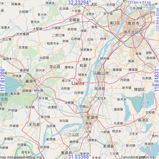
Lianhe GPS coordinates[2]
31° 38' 10.464" North, 118° 18' 54.648" East
| Map corner | latitude | longitude |
|---|---|---|
| Upper-left | 32.23294°, | 117.61206° |
| Center: | 31.63624°, | 118.31518° |
| Lower-right: | 31.03568°, | 119.01831° |
| Map W x H: | 133.1×133.1 km | = 82.7×82.7mi |
| max Lat: | 53.31946° ⇑40.8% North |
| Lianhe: | 31.63624° |
| min Lat: | ⇓59.2% South 18.22056° |
| min Long | Lianhe | max Long |
| 75.07348° | 118.31518° | 134.28917° |
| W 72.1%⇐ | ⇒27.9% E |
Elevation
Elevation of Lianhe is 9 m = 30 ft, and this is 475.8 m = 1561 ft below average elevation for this country.
| Max E: |
5622 m = 18445 ft | 91.2% |
| Avg. | 484.8 m = 1591 ft | |
| Lianhe | 9 m = 30 ft | |
Min E: |
-3 m = -10 ft | 8.8% |
See also: China elevation on elevation.city.
Geographical zone
Lianhe is located in North temperate zone (between Tropic of Cancer and the Arctic Circle). Distance of this Northern Tropic circle is 911.7 km =566.5 mi to South.| Distance of | km | miles | from Lianhe |
|---|---|---|---|
| North Pole | 6489.4 | 4032.3 | to North |
| Arctic Circle | 3883.6 | 2413.2 | to North |
| Tropic Cancer | 911.7 | 566.5 | to South |
| Equator | 3517.6 | 2185.7 | to South |


Nearby cities:
15 places around Lianhe: (largest is in red/bold)
• Baiqiao
11 km =6.8 mi,  183°
183°
• Caishi
14 km =8.7 mi,  84°
84°
• Chengnan
5.1 km =3.2 mi,  31°
31°
• Dongjiang Matoukou
13.8 km =8.6 mi,  108°
108°
• Gongqiao
14.4 km =8.9 mi,  239°
239°
• Gushu
17.9 km =11.1 mi,  118°
118°
• Jinjiazhuang
19 km =11.8 mi,  60°
60°
• Laoqiao
3.3 km =2.1 mi,  202°
202°
• Liu‘an
19.8 km =12.3 mi, 84°
• Liyang
9.9 km =6.2 mi,  23°
23°
• Ma’anshan
19.3 km =12 mi,  73°
73°
• Taochang
18.8 km =11.7 mi,  256°
256°
• Xibu
16.1 km =10 mi,  349°
349°
• Xinqiao
18.9 km =11.7 mi,  136°
136°
• Yushan
16.5 km =10.3 mi, 75°
Sources, notices
• [Note1] Compared only with cities in China existing in our database
• [Src1] Map data: © OpenStreetMap contributors (CC-BY-SA)
• [Src2] Other city data from geonames.org with taken over terms of usage.
• [Src3] Geographical zone / Annual Mean Temperature by Robert A. Rohde @ Wikipedia
