Gushu geodata
Gushu (Anhui) is a seat of a third-order administrative division; located in China in Asia/Shanghai (GMT+8) time zone. With population of 60,335 people, there are 726 cities with bigger population in this country. Compared to other cities in China, 58.8% of cities are located further ↓South; 73.1% of cities are located further ←West and 86.9% of cities have higher elevation than Gushu. Note1


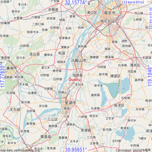
Gushu GPS coordinates[2]
31° 33' 37.98" North, 118° 28' 53.292" East
| Map corner | latitude | longitude |
|---|---|---|
| Upper-left | 32.15774°, | 117.77835° |
| Center: | 31.56055°, | 118.48147° |
| Lower-right: | 30.95951°, | 119.1846° |
| Map W x H: | 133.2×133.2 km | = 82.8×82.8mi |
| max Lat: | 53.31946° ⇑41.2% North |
| Gushu: | 31.56055° |
| min Lat: | ⇓58.8% South 18.22056° |
| min Long | Gushu | max Long |
| 75.07348° | 118.48147° | 134.28917° |
| W 73.1%⇐ | ⇒26.9% E |
Elevation
Elevation of Gushu is 13 m = 43 ft, and this is 471.8 m = 1548 ft below average elevation for this country.
| Max E: |
5622 m = 18445 ft | 86.9% |
| Avg. | 484.8 m = 1591 ft | |
| Gushu | 13 m = 43 ft | |
Min E: |
-3 m = -10 ft | 13.1% |
See also: Gushu elevation on elevation.city.
Geographical zone
Gushu is located in North temperate zone (between Tropic of Cancer and the Arctic Circle). Distance of this Northern Tropic circle is 903.3 km =561.3 mi to South.| Distance of | km | miles | from Gushu |
|---|---|---|---|
| North Pole | 6497.9 | 4037.6 | to North |
| Arctic Circle | 3892 | 2418.4 | to North |
| Tropic Cancer | 903.3 | 561.3 | to South |
| Equator | 3509.2 | 2180.5 | to South |


Nearby cities:
15 places around Gushu: (largest is in red/bold)
• Baiqiao
16.6 km =10.3 mi,  261°
261°
• Caishi
9.9 km =6.2 mi,  349°
349°
• Daqiao
12.6 km =7.8 mi,  213°
213°
• Dongjiang Matoukou
4.9 km =3 mi,  327°
327°
• Huhe
11.6 km =7.2 mi,  118°
118°
• Liu‘an
11.1 km =6.9 mi,  21°
21°
• Longshanqiao
7.2 km =4.5 mi,  179°
179°
• Ma’anshan
14.2 km =8.8 mi,  11°
11°
• Niandou
14.2 km =8.8 mi,  188°
188°
• Taibai
7.5 km =4.7 mi,  158°
158°
• Xiangshan
14.9 km =9.3 mi,  41°
41°
• Xinqiao
6.1 km =3.8 mi, 207°
• Xuejin
15.4 km =9.6 mi,  83°
83°
• Yintang
6.4 km =4 mi, 44°
• Yushan
12.5 km =7.8 mi,  1°
1°
Sources, notices
• [Note1] Compared only with cities in China existing in our database
• [Src1] Map data: © OpenStreetMap contributors (CC-BY-SA)
• [Src2] Other city data from geonames.org with taken over terms of usage.
• [Src3] Geographical zone / Annual Mean Temperature by Robert A. Rohde @ Wikipedia
