San Sebastián de Buenavista geodata
San Sebastián de Buenavista (Magdalena) is a seat of a second-order administrative division; located in Colombia in America/Bogota (GMT-5) time zone. In our database, there are 1053 cities with bigger population. Compared to other cities in Colombia, 88.6% of cities are located further ↓South; 59.6% of cities are located further ←West and 91.2% of cities have higher elevation than San Sebastián de Buenavista. Note1
Current local time in San Sebastián de Buenavista:
07:06 AM, MondayDifference from your time zone: hours


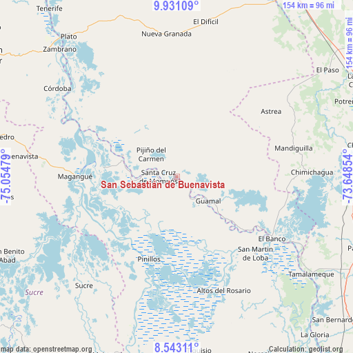
San Sebastián de Buenavista GPS coordinates[2]
9° 14' 16.008" North, 74° 21' 5.976" West
| Map corner | latitude | longitude |
|---|---|---|
| Upper-left | 9.93109°, | -75.05479° |
| Center: | 9.23778°, | -74.35166° |
| Lower-right: | 8.54311°, | -73.64854° |
| Map W x H: | 154.3×154.3 km | = 95.9×95.9mi |
| max Lat: | 13.38166° ⇑11.4% North |
| San Sebastián de Buenavista: | 9.23778° |
| min Lat: | ⇓88.6% South -4.21528° |
| min Long | San Sebastián | max Long |
| -81.70636° | -74.35166° | -67.06996° |
| W 59.6%⇐ | ⇒40.4% E |
Elevation
Elevation of San Sebastián de Buenavista is 25 m = 82 ft, and this is 1124.3 m = 3689 ft below average elevation for this country.
| Max E: |
3342 m = 10965 ft | 91.2% |
| Avg. | 1149.3 m = 3771 ft | |
| San Sebastián de Buenavista | 25 m = 82 ft | |
Min E: |
1 m = 3 ft | 8.8% |
See also: Colombia elevation on elevation.city.
Geographical zone
San Sebastián de Buenavista is located in North Torrid zone (between Equator and Tropic of Cancer). Distance of Equator is 1027.1 km =638.2 mi to South.| Distance of | km | miles | from San Sebastián de Buenavista |
|---|---|---|---|
| North Pole | 8979.9 | 5579.8 | to North |
| Arctic Circle | 6374 | 3960.6 | to North |
| Tropic Cancer | 1578.8 | 981 | to North |
| Equator | 1027.1 | 638.2 | to South |


Nearby cities:
15 places around San Sebastián de Buenavista: (largest is in red/bold)
• Barranco de Loba
42.2 km =26.2 mi,  140°
140°
• Buenavista
4.9 km =3 mi,  121°
121°
• Cicuco
32.3 km =20.1 mi,  277°
277°
• Guamal
17.5 km =10.9 mi,  126°
126°
• Hatillo de Loba
43.4 km =27 mi, 136°
• Margarita
13.1 km =8.1 mi, 134°
• Mompós
8.2 km =5.1 mi,  273°
273°
• Pijiño del Carmen
15.1 km =9.4 mi,  312°
312°
• Pinillos
37.6 km =23.4 mi,  199°
199°
• San Fernando
4.8 km =3 mi, 128°
• San Fernando
20.5 km =12.7 mi, 283°
• San Zenón
16.3 km =10.1 mi, 271°
• Santa Ana
25.5 km =15.8 mi,  291°
291°
• Talaigua Nuevo
24.5 km =15.2 mi, 287°
• Talaigua Viejo
27 km =16.8 mi, 287°
Sources, notices
• [Note1] Compared only with cities in Colombia existing in our database
• [Src1] Map data: © OpenStreetMap contributors (CC-BY-SA)
• [Src2] Other city data from geonames.org with taken over terms of usage.
• [Src3] Geographical zone / Annual Mean Temperature by Robert A. Rohde @ Wikipedia
