San Fernando geodata
San Fernando (Bolívar) is a populated place; located in Colombia in America/Bogota (GMT-5) time zone. With population of 1,615 people, there are 851 cities with bigger population in this country. Compared to other cities in Colombia, 89.4% of cities are located further ↓South; 56.2% of cities are located further ←West and 93.7% of cities have higher elevation than San Fernando. Note1


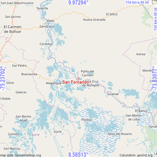
San Fernando GPS coordinates[2]
9° 16' 46.992" North, 74° 32' 2.004" West
| Map corner | latitude | longitude |
|---|---|---|
| Upper-left | 9.97294°, | -75.23702° |
| Center: | 9.27972°, | -74.53389° |
| Lower-right: | 8.58513°, | -73.83077° |
| Map W x H: | 154.3×154.3 km | = 95.9×95.9mi |
| max Lat: | 13.38166° ⇑10.6% North |
| San Fernando: | 9.27972° |
| min Lat: | ⇓89.4% South -4.21528° |
| min Long | San Fernando | max Long |
| -81.70636° | -74.53389° | -67.06996° |
| W 56.2%⇐ | ⇒43.8% E |
Elevation
Elevation of San Fernando is 17 m = 56 ft, and this is 1132.3 m = 3715 ft below average elevation for this country.
| Max E: |
3342 m = 10965 ft | 93.7% |
| Avg. | 1149.3 m = 3771 ft | |
| San Fernando | 17 m = 56 ft | |
Min E: |
1 m = 3 ft | 6.3% |
See also: Colombia elevation on elevation.city.
Geographical zone
San Fernando is located in North Torrid zone (between Equator and Tropic of Cancer). Distance of Equator is 1031.8 km =641.1 mi to South.| Distance of | km | miles | from San Fernando |
|---|---|---|---|
| North Pole | 8975.3 | 5577 | to North |
| Arctic Circle | 6369.4 | 3957.8 | to North |
| Tropic Cancer | 1574.1 | 978.1 | to North |
| Equator | 1031.8 | 641.1 | to South |


Nearby cities:
15 places around San Fernando: (largest is in red/bold)
• Buenavista
25.2 km =15.7 mi,  106°
106°
• Cicuco
12 km =7.5 mi,  268°
268°
• Guamal
37.3 km =23.2 mi, 114°
• Magangué
24.6 km =15.3 mi,  260°
260°
• Margarita
32.4 km =20.1 mi,  115°
115°
• Mompós
12.5 km =7.8 mi, 109°
• Pijiño del Carmen
10.4 km =6.5 mi,  58°
58°
• Pinillos
40.7 km =25.3 mi,  169°
169°
• San Fernando
24.9 km =15.5 mi, 107°
• San Sebastián de Buenavista
20.5 km =12.7 mi,  103°
103°
• San Zenón
5.6 km =3.5 mi,  138°
138°
• Santa Ana
6 km =3.7 mi,  320°
320°
• Santa Bárbara de Pinto
25.2 km =15.7 mi,  312°
312°
• Talaigua Nuevo
4.3 km =2.7 mi, 307°
• Talaigua Viejo
6.7 km =4.2 mi,  302°
302°
Sources, notices
• [Note1] Compared only with cities in Colombia existing in our database
• [Src1] Map data: © OpenStreetMap contributors (CC-BY-SA)
• [Src2] Other city data from geonames.org with taken over terms of usage.
• [Src3] Geographical zone / Annual Mean Temperature by Robert A. Rohde @ Wikipedia
