Černá v Pošumaví geodata
Černá v Pošumaví (Jihočeský kraj) is a populated place; located in Czech Republic in Europe/Prague (GMT+2) time zone. With population of 835 people, there are 1536 cities with bigger population in this country. Compared to other cities in Czech Republic, 99.6% of cities are located further ↑North; 81.5% of cities are located further →East and 99% of cities have lower elevation than Černá v Pošumaví. Note1
Administrative division(s):
- Level 1: Jihočeský kraj
- Level 2: Okres Český Krumlov
- Level 3: Černá v Pošumaví


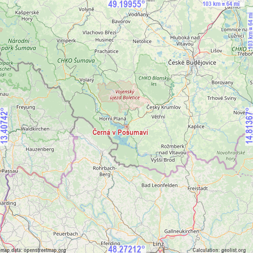
Černá v Pošumaví GPS coordinates[2]
48° 44' 16.692" North, 14° 6' 37.944" East
| Map corner | latitude | longitude |
|---|---|---|
| Upper-left | 49.19955°, | 13.40742° |
| Center: | 48.73797°, | 14.11054° |
| Lower-right: | 48.27212°, | 14.81367° |
| Map W x H: | 103.1×103.1 km | = 64.1×64.1mi |
| max Lat: | 51.01104° ⇑99.6% North |
| Černá v Pošumaví: | 48.73797° |
| min Lat: | ⇓0.4% South 48.60378° |
| min Long | Černá v Pošu | max Long |
| 12.17577° | 14.11054° | 18.82683° |
| W 18.5%⇐ | ⇒81.5% E |
Elevation
Elevation of Černá v Pošumaví is 727 m = 2385 ft, and this is 375 m = 1230 ft above average elevation for this country.
| Max E: |
901 m = 2956 ft | 1% |
| Černá v Pošumaví | 727 m 2385 ft | |
| Avg. | 352 m = 1155 ft | |
Min E: |
136 m = 446 ft | 99% |
See also: Czech Republic elevation on elevation.city.
Geographical zone
Černá v Pošumaví is located in North temperate zone (between Tropic of Cancer and the Arctic Circle). Distance of this North polar circle is 1982 km =1231.6 mi to North.| Distance of | km | miles | from Černá v Pošumaví |
|---|---|---|---|
| North Pole | 4587.9 | 2850.8 | to North |
| Arctic Circle | 1982 | 1231.6 | to North |
| Tropic Cancer | 2813.2 | 1748 | to South |
| Equator | 5419.2 | 3367.3 | to South |


Nearby cities:
15 places around Černá v Pošumaví: (largest is in red/bold)
• Brloh
22.8 km =14.2 mi,  20°
20°
• Chvalšiny
14.9 km =9.3 mi,  29°
29°
• Frymburk
9.5 km =5.9 mi,  154°
154°
• Horní Planá
6.6 km =4.1 mi,  299°
299°
• Hořice na Šumavě
5.9 km =3.7 mi,  58°
58°
• Ktiš
20 km =12.4 mi,  4°
4°
• Kájov
13.5 km =8.4 mi,  53°
53°
• Lipno nad Vltavou
14 km =8.7 mi,  141°
141°
• Loučovice
17 km =10.6 mi, 140°
• Nová Pec
14.1 km =8.8 mi,  287°
287°
• Přídolí
18.3 km =11.4 mi,  74°
74°
• Sedlice
21 km =13 mi,  78°
78°
• Vyšší Brod
20.1 km =12.5 mi,  132°
132°
• Větřní
13.5 km =8.4 mi, 72°
• Český Krumlov
17 km =10.6 mi, 61°
Sources, notices
• [Note1] Compared only with cities in Czech Republic existing in our database
• [Src1] Map data: © OpenStreetMap contributors (CC-BY-SA)
• [Src2] Other city data from geonames.org with taken over terms of usage.
• [Src3] Geographical zone / Annual Mean Temperature by Robert A. Rohde @ Wikipedia
