Zusamaltheim geodata
Zusamaltheim (Bavaria) is a seat of a fourth-order administrative division; located in Germany in Europe/Berlin (GMT+2) time zone. With population of 1,290 people, there are 6336 cities with bigger population in this country. Compared to other cities in Germany, 88.7% of cities are located further ↑North; 61.4% of cities are located further ←West and 81.7% of cities have lower elevation than Zusamaltheim. Note1
Administrative division(s):
- Level 1: Bavaria
- Level 2: Swabia
- Level 3: Landkreis Dillingen an der Donau
- Level 4: Zusamaltheim


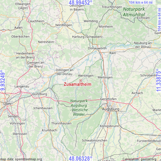
Zusamaltheim GPS coordinates[2]
48° 31' 51.744" North, 10° 38' 8.232" East
| Map corner | latitude | longitude |
|---|---|---|
| Upper-left | 48.99452°, | 9.93249° |
| Center: | 48.53104°, | 10.63562° |
| Lower-right: | 48.06328°, | 11.33875° |
| Map W x H: | 103.5×103.5 km | = 64.3×64.3mi |
| max Lat: | 55.01917° ⇑88.7% North |
| Zusamaltheim: | 48.53104° |
| min Lat: | ⇓11.3% South 47.40724° |
| min Long | Zusamaltheim | max Long |
| 5.92978° | 10.63562° | 14.98853° |
| W 61.4%⇐ | ⇒38.6% E |
Elevation
Elevation of Zusamaltheim is 444 m = 1457 ft, and this is 194.9 m = 639 ft above average elevation for this country.
| Max E: |
1256 m = 4121 ft | 18.3% |
| Zusamaltheim | 444 m 1457 ft | |
| Avg. | 249.1 m = 817 ft | |
Min E: |
-5 m = -16 ft | 81.7% |
See also: Germany elevation on elevation.city.
Geographical zone
Zusamaltheim is located in North temperate zone (between Tropic of Cancer and the Arctic Circle). Distance of this North polar circle is 2005 km =1245.8 mi to North.| Distance of | km | miles | from Zusamaltheim |
|---|---|---|---|
| North Pole | 4610.9 | 2865.1 | to North |
| Arctic Circle | 2005 | 1245.8 | to North |
| Tropic Cancer | 2790.2 | 1733.7 | to South |
| Equator | 5396.1 | 3353 | to South |


Nearby cities:
15 places around Zusamaltheim: (largest is in red/bold)
• Altenmünster
8.1 km =5 mi,  204°
204°
• Binswangen
3 km =1.9 mi,  9°
9°
• Blindheim
11.2 km =7 mi,  354°
354°
• Bonstetten
11.3 km =7 mi,  153°
153°
• Buttenwiesen
9.7 km =6 mi,  37°
37°
• Dillingen an der Donau
11.8 km =7.3 mi,  298°
298°
• Emersacker
5.4 km =3.4 mi, 148°
• Glött
11.7 km =7.3 mi,  252°
252°
• Heretsried
10.8 km =6.7 mi,  136°
136°
• Holzheim
8 km =5 mi,  256°
256°
• Höchstädt an der Donau
10.2 km =6.3 mi,  330°
330°
• Laugna
4.7 km =2.9 mi,  86°
86°
• Villenbach
2.9 km =1.8 mi,  212°
212°
• Welden
8.7 km =5.4 mi,  167°
167°
• Wertingen
4.9 km =3 mi, 43°
Sources, notices
• [Note1] Compared only with cities in Germany existing in our database
• [Src1] Map data: © OpenStreetMap contributors (CC-BY-SA)
• [Src2] Other city data from geonames.org with taken over terms of usage.
• [Src3] Geographical zone / Annual Mean Temperature by Robert A. Rohde @ Wikipedia
