Altenmünster geodata
Altenmünster (Bavaria) is a seat of a fourth-order administrative division; located in Germany in Europe/Berlin (GMT+2) time zone. With population of 3,846 people, there are 3381 cities with bigger population in this country. Compared to other cities in Germany, 89.5% of cities are located further ↑North; 60.6% of cities are located further ←West and 80.3% of cities have lower elevation than Altenmünster. Note1
Administrative division(s):
- Level 1: Bavaria
- Level 2: Swabia
- Level 3: Landkreis Augsburg
- Level 4: Altenmünster


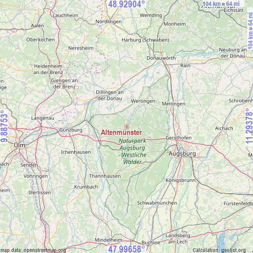
Altenmünster GPS coordinates[2]
48° 27' 53.82" North, 10° 35' 26.34" East
| Map corner | latitude | longitude |
|---|---|---|
| Upper-left | 48.92904°, | 9.88753° |
| Center: | 48.46495°, | 10.59065° |
| Lower-right: | 47.99658°, | 11.29378° |
| Map W x H: | 103.7×103.7 km | = 64.4×64.4mi |
| max Lat: | 55.01917° ⇑89.5% North |
| Altenmünster: | 48.46495° |
| min Lat: | ⇓10.5% South 47.40724° |
| min Long | Altenmünster | max Long |
| 5.92978° | 10.59065° | 14.98853° |
| W 60.6%⇐ | ⇒39.4% E |
Elevation
Elevation of Altenmünster is 435 m = 1427 ft, and this is 185.9 m = 610 ft above average elevation for this country.
| Max E: |
1256 m = 4121 ft | 19.7% |
| Altenmünster | 435 m 1427 ft | |
| Avg. | 249.1 m = 817 ft | |
Min E: |
-5 m = -16 ft | 80.3% |
See also: Germany elevation on elevation.city.
Geographical zone
Altenmünster is located in North temperate zone (between Tropic of Cancer and the Arctic Circle). Distance of this North polar circle is 2012.4 km =1250.4 mi to North.| Distance of | km | miles | from Altenmünster |
|---|---|---|---|
| North Pole | 4618.3 | 2869.7 | to North |
| Arctic Circle | 2012.4 | 1250.4 | to North |
| Tropic Cancer | 2782.9 | 1729.2 | to South |
| Equator | 5388.8 | 3348.4 | to South |


Nearby cities:
15 places around Altenmünster: (largest is in red/bold)
• Adelsried
10.4 km =6.5 mi,  115°
115°
• Aislingen
10.8 km =6.7 mi,  295°
295°
• Bonstetten
8.9 km =5.5 mi,  108°
108°
• Emersacker
6.7 km =4.2 mi,  65°
65°
• Glött
8.8 km =5.5 mi, 296°
• Heretsried
10.7 km =6.6 mi,  93°
93°
• Holzheim
7 km =4.3 mi,  321°
321°
• Horgau
10.3 km =6.4 mi,  138°
138°
• Landensberg
6 km =3.7 mi,  235°
235°
• Roßhaupten
9.8 km =6.1 mi,  246°
246°
• Villenbach
5.2 km =3.2 mi,  19°
19°
• Welden
5.3 km =3.3 mi,  102°
102°
• Winterbach
7.9 km =4.9 mi,  271°
271°
• Zusamaltheim
8.1 km =5 mi, 24°
• Zusmarshausen
7.2 km =4.5 mi,  175°
175°
Sources, notices
• [Note1] Compared only with cities in Germany existing in our database
• [Src1] Map data: © OpenStreetMap contributors (CC-BY-SA)
• [Src2] Other city data from geonames.org with taken over terms of usage.
• [Src3] Geographical zone / Annual Mean Temperature by Robert A. Rohde @ Wikipedia
