Wolmersdorf geodata
Wolmersdorf (Schleswig-Holstein) is a seat of a fourth-order administrative division; located in Germany in Europe/Berlin (GMT+2) time zone. With population of 355 people, there are 9854 cities with bigger population in this country. Compared to other cities in Germany, 93.6% of cities are located further ↓South; 63.9% of cities are located further →East and 93.9% of cities have higher elevation than Wolmersdorf. Note1
Administrative division(s):
- Level 1: Schleswig-Holstein
- Level 3: Kreis Dithmarschen
- Level 4: Wolmersdorf


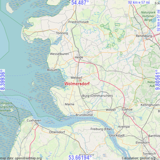
Wolmersdorf GPS coordinates[2]
54° 4' 35.472" North, 9° 6' 8.928" East
| Map corner | latitude | longitude |
|---|---|---|
| Upper-left | 54.487°, | 8.39936° |
| Center: | 54.07652°, | 9.10248° |
| Lower-right: | 53.66194°, | 9.80561° |
| Map W x H: | 91.7×91.7 km | = 57×57mi |
| max Lat: | 55.01917° ⇑6.4% North |
| Wolmersdorf: | 54.07652° |
| min Lat: | ⇓93.6% South 47.40724° |
| min Long | Wolmersdorf | max Long |
| 5.92978° | 9.10248° | 14.98853° |
| W 36.1%⇐ | ⇒63.9% E |
Elevation
Elevation of Wolmersdorf is 11 m = 36 ft, and this is 238.1 m = 781 ft below average elevation for this country.
| Max E: |
1256 m = 4121 ft | 93.9% |
| Avg. | 249.1 m = 817 ft | |
| Wolmersdorf | 11 m = 36 ft | |
Min E: |
-5 m = -16 ft | 6.1% |
See also: Germany elevation on elevation.city.
Geographical zone
Wolmersdorf is located in North temperate zone (between Tropic of Cancer and the Arctic Circle). Distance of this North polar circle is 1388.4 km =862.7 mi to North.| Distance of | km | miles | from Wolmersdorf |
|---|---|---|---|
| North Pole | 3994.3 | 2481.9 | to North |
| Arctic Circle | 1388.4 | 862.7 | to North |
| Tropic Cancer | 3406.8 | 2116.9 | to South |
| Equator | 6012.7 | 3736.1 | to South |


Nearby cities:
15 places around Wolmersdorf: (largest is in red/bold)
• Bargenstedt
4.1 km =2.5 mi,  49°
49°
• Barlt
7.5 km =4.7 mi,  207°
207°
• Busenwurth
5.8 km =3.6 mi,  227°
227°
• Elpersbüttel
3.7 km =2.3 mi,  262°
262°
• Epenwöhrden
4.9 km =3 mi,  319°
319°
• Frestedt
7.1 km =4.4 mi,  132°
132°
• Gudendorf
5.8 km =3.6 mi,  176°
176°
• Hemmingstedt
8.5 km =5.3 mi,  344°
344°
• Krumstedt
5.4 km =3.4 mi,  101°
101°
• Meldorf
2.8 km =1.7 mi,  307°
307°
• Nindorf
1.2 km =0.7 mi, 50°
• Sarzbüttel
6.9 km =4.3 mi, 49°
• Süderhastedt
7.5 km =4.7 mi,  113°
113°
• Tensbüttel-Röst
8.9 km =5.5 mi,  72°
72°
• Windbergen
3.1 km =1.9 mi,  162°
162°
Sources, notices
• [Note1] Compared only with cities in Germany existing in our database
• [Src1] Map data: © OpenStreetMap contributors (CC-BY-SA)
• [Src2] Other city data from geonames.org with taken over terms of usage.
• [Src3] Geographical zone / Annual Mean Temperature by Robert A. Rohde @ Wikipedia
