Werder geodata
Werder (Mecklenburg-Vorpommern) is a populated place; located in Germany in Europe/Berlin (GMT+2) time zone. With population of 502 people, there are 9363 cities with bigger population in this country. Compared to other cities in Germany, 85.6% of cities are located further ↓South; 81.9% of cities are located further ←West and 75.5% of cities have higher elevation than Werder. Note1
Administrative division(s):
- Level 1: Mecklenburg-Vorpommern
- Level 3: Ludwigslust-Parchim
- Level 4: Werder


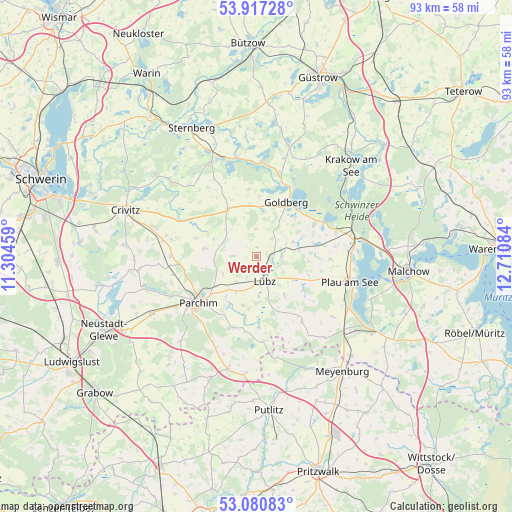
Werder GPS coordinates[2]
53° 30' 4.032" North, 12° 0' 27.756" East
| Map corner | latitude | longitude |
|---|---|---|
| Upper-left | 53.91728°, | 11.30459° |
| Center: | 53.50112°, | 12.00771° |
| Lower-right: | 53.08083°, | 12.71084° |
| Map W x H: | 93×93 km | = 57.8×57.8mi |
| max Lat: | 55.01917° ⇑14.4% North |
| Werder: | 53.50112° |
| min Lat: | ⇓85.6% South 47.40724° |
| min Long | Werder | max Long |
| 5.92978° | 12.00771° | 14.98853° |
| W 81.9%⇐ | ⇒18.1% E |
Elevation
Elevation of Werder is 61 m = 200 ft, and this is 188.1 m = 617 ft below average elevation for this country.
| Max E: |
1256 m = 4121 ft | 75.5% |
| Avg. | 249.1 m = 817 ft | |
| Werder | 61 m = 200 ft | |
Min E: |
-5 m = -16 ft | 24.5% |
See also: Germany elevation on elevation.city.
Geographical zone
Werder is located in North temperate zone (between Tropic of Cancer and the Arctic Circle). Distance of this North polar circle is 1452.4 km =902.5 mi to North.| Distance of | km | miles | from Werder |
|---|---|---|---|
| North Pole | 4058.3 | 2521.7 | to North |
| Arctic Circle | 1452.4 | 902.5 | to North |
| Tropic Cancer | 3342.8 | 2077.1 | to South |
| Equator | 5948.8 | 3696.4 | to South |


Nearby cities:
15 places around Werder: (largest is in red/bold)
• Diestelow
6.7 km =4.2 mi,  35°
35°
• Gallin
7.8 km =4.8 mi,  82°
82°
• Goldberg
11.1 km =6.9 mi,  28°
28°
• Grambow
5.5 km =3.4 mi,  23°
23°
• Granzin
4.3 km =2.7 mi,  272°
272°
• Grebbin
9.7 km =6 mi,  279°
279°
• Greven
2.8 km =1.7 mi,  228°
228°
• Lübz
4.5 km =2.8 mi,  161°
161°
• Mestlin
10.3 km =6.4 mi,  328°
328°
• Neu Poserin
11.9 km =7.4 mi,  60°
60°
• Neuburg
12.1 km =7.5 mi,  209°
209°
• Parchim
13.4 km =8.3 mi, 231°
• Passow
3.1 km =1.9 mi, 77°
• Rom
7.4 km =4.6 mi, 211°
• Techentin
9.7 km =6 mi,  352°
352°
Sources, notices
• [Note1] Compared only with cities in Germany existing in our database
• [Src1] Map data: © OpenStreetMap contributors (CC-BY-SA)
• [Src2] Other city data from geonames.org with taken over terms of usage.
• [Src3] Geographical zone / Annual Mean Temperature by Robert A. Rohde @ Wikipedia
