Welschneudorf geodata
Welschneudorf (Rheinland-Pfalz) is a seat of a fourth-order administrative division; located in Germany in Europe/Berlin (GMT+2) time zone. With population of 962 people, there are 7307 cities with bigger population in this country. Compared to other cities in Germany, 55.2% of cities are located further ↑North; 81% of cities are located further →East and 77.6% of cities have lower elevation than Welschneudorf. Note1
Administrative division(s):
- Level 1: Rheinland-Pfalz
- Level 3: Westerwaldkreis
- Level 4: Welschneudorf


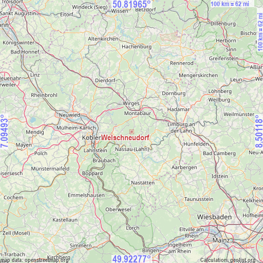
Welschneudorf GPS coordinates[2]
50° 22' 23.988" North, 7° 47' 53.016" East
| Map corner | latitude | longitude |
|---|---|---|
| Upper-left | 50.81965°, | 7.09493° |
| Center: | 50.37333°, | 7.79806° |
| Lower-right: | 49.92277°, | 8.50118° |
| Map W x H: | 99.7×99.7 km | = 62×62mi |
| max Lat: | 55.01917° ⇑55.2% North |
| Welschneudorf: | 50.37333° |
| min Lat: | ⇓44.8% South 47.40724° |
| min Long | Welschneudorf | max Long |
| 5.92978° | 7.79806° | 14.98853° |
| W 19%⇐ | ⇒81% E |
Elevation
Elevation of Welschneudorf is 416 m = 1365 ft, and this is 166.9 m = 548 ft above average elevation for this country.
| Max E: |
1256 m = 4121 ft | 22.4% |
| Welschneudorf | 416 m 1365 ft | |
| Avg. | 249.1 m = 817 ft | |
Min E: |
-5 m = -16 ft | 77.6% |
See also: Germany elevation on elevation.city.
Geographical zone
Welschneudorf is located in North temperate zone (between Tropic of Cancer and the Arctic Circle). Distance of this North polar circle is 1800.2 km =1118.6 mi to North.| Distance of | km | miles | from Welschneudorf |
|---|---|---|---|
| North Pole | 4406.1 | 2737.8 | to North |
| Arctic Circle | 1800.2 | 1118.6 | to North |
| Tropic Cancer | 2995.1 | 1861.1 | to South |
| Equator | 5601 | 3480.3 | to South |


Nearby cities:
15 places around Welschneudorf: (largest is in red/bold)
• Arzbach
3.5 km =2.2 mi,  280°
280°
• Daubach
4.7 km =2.9 mi,  51°
51°
• Dausenau
5 km =3.1 mi,  206°
206°
• Gackenbach
4.9 km =3 mi,  98°
98°
• Horbach
3.9 km =2.4 mi,  90°
90°
• Hömberg
4.6 km =2.9 mi,  193°
193°
• Hübingen
3.8 km =2.4 mi,  115°
115°
• Kadenbach
4.7 km =2.9 mi, 283°
• Kemmenau
4.3 km =2.7 mi,  232°
232°
• Niederelbert
3.9 km =2.4 mi,  12°
12°
• Oberelbert
2.5 km =1.6 mi,  33°
33°
• Stahlhofen
4.9 km =3 mi,  62°
62°
• Untershausen
4.7 km =2.9 mi, 51°
• Winden
5.1 km =3.2 mi,  150°
150°
• Zimmerschied
2.8 km =1.7 mi,  201°
201°
Sources, notices
• [Note1] Compared only with cities in Germany existing in our database
• [Src1] Map data: © OpenStreetMap contributors (CC-BY-SA)
• [Src2] Other city data from geonames.org with taken over terms of usage.
• [Src3] Geographical zone / Annual Mean Temperature by Robert A. Rohde @ Wikipedia
