Wellendingen geodata
Wellendingen (Baden-Württemberg) is a seat of a fourth-order administrative division; located in Germany in Europe/Berlin (GMT+2) time zone. With population of 3,117 people, there are 3902 cities with bigger population in this country. Compared to other cities in Germany, 93.4% of cities are located further ↑North; 69% of cities are located further →East and 96.1% of cities have lower elevation than Wellendingen. Note1
Administrative division(s):
- Level 1: Baden-Württemberg
- Level 2: Freiburg Region
- Level 3: Landkreis Rottweil
- Level 4: Wellendingen


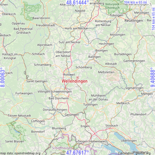
Wellendingen GPS coordinates[2]
48° 8' 50.82" North, 8° 42' 13.5" East
| Map corner | latitude | longitude |
|---|---|---|
| Upper-left | 48.61444°, | 8.00063° |
| Center: | 48.14745°, | 8.70375° |
| Lower-right: | 47.67617°, | 9.40688° |
| Map W x H: | 104.3×104.3 km | = 64.8×64.8mi |
| max Lat: | 55.01917° ⇑93.4% North |
| Wellendingen: | 48.14745° |
| min Lat: | ⇓6.6% South 47.40724° |
| min Long | Wellendingen | max Long |
| 5.92978° | 8.70375° | 14.98853° |
| W 31%⇐ | ⇒69% E |
Elevation
Elevation of Wellendingen is 633 m = 2077 ft, and this is 383.9 m = 1260 ft above average elevation for this country.
| Max E: |
1256 m = 4121 ft | 3.9% |
| Wellendingen | 633 m 2077 ft | |
| Avg. | 249.1 m = 817 ft | |
Min E: |
-5 m = -16 ft | 96.1% |
See also: Germany elevation on elevation.city.
Geographical zone
Wellendingen is located in North temperate zone (between Tropic of Cancer and the Arctic Circle). Distance of this North polar circle is 2047.7 km =1272.4 mi to North.| Distance of | km | miles | from Wellendingen |
|---|---|---|---|
| North Pole | 4653.6 | 2891.6 | to North |
| Arctic Circle | 2047.7 | 1272.4 | to North |
| Tropic Cancer | 2747.6 | 1707.3 | to South |
| Equator | 5353.5 | 3326.5 | to South |


Nearby cities:
15 places around Wellendingen: (largest is in red/bold)
• Aldingen
5.3 km =3.3 mi,  183°
183°
• Deilingen
6.7 km =4.2 mi,  63°
63°
• Deißlingen
8.2 km =5.1 mi,  241°
241°
• Denkingen
4.8 km =3 mi,  147°
147°
• Dietingen
7.6 km =4.7 mi,  327°
327°
• Frittlingen
2.3 km =1.4 mi,  172°
172°
• Gosheim
4 km =2.5 mi,  111°
111°
• Ratshausen
8.5 km =5.3 mi,  52°
52°
• Rottweil
6.1 km =3.8 mi,  291°
291°
• Schömberg
8.1 km =5 mi,  30°
30°
• Spaichingen
8.4 km =5.2 mi,  163°
163°
• Wehingen
6.5 km =4 mi,  92°
92°
• Weilen unter den Rinnen
6.5 km =4 mi,  43°
43°
• Zimmern ob Rottweil
8.4 km =5.2 mi,  284°
284°
• Zimmern unter der Burg
8.2 km =5.1 mi,  8°
8°
Sources, notices
• [Note1] Compared only with cities in Germany existing in our database
• [Src1] Map data: © OpenStreetMap contributors (CC-BY-SA)
• [Src2] Other city data from geonames.org with taken over terms of usage.
• [Src3] Geographical zone / Annual Mean Temperature by Robert A. Rohde @ Wikipedia
