Schömberg geodata
Schömberg (Baden-Württemberg) is a populated place; located in Germany in Europe/Berlin (GMT+2) time zone. With population of 4,633 people, there are 2974 cities with bigger population in this country. Compared to other cities in Germany, 92.6% of cities are located further ↑North; 68.4% of cities are located further →East and 97.3% of cities have lower elevation than Schömberg. Note1
Administrative division(s):
- Level 1: Baden-Württemberg
- Level 2: Tübingen Region
- Level 3: Zollernalbkreis
- Level 4: Schömberg


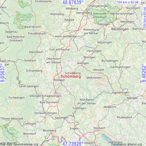
Schömberg GPS coordinates[2]
48° 12' 35.892" North, 8° 45' 34.164" East
| Map corner | latitude | longitude |
|---|---|---|
| Upper-left | 48.67639°, | 8.05637° |
| Center: | 48.20997°, | 8.75949° |
| Lower-right: | 47.73926°, | 9.46262° |
| Map W x H: | 104.2×104.2 km | = 64.7×64.7mi |
| max Lat: | 55.01917° ⇑92.6% North |
| Schömberg: | 48.20997° |
| min Lat: | ⇓7.4% South 47.40724° |
| min Long | Schömberg | max Long |
| 5.92978° | 8.75949° | 14.98853° |
| W 31.6%⇐ | ⇒68.4% E |
Elevation
Elevation of Schömberg is 677 m = 2221 ft, and this is 427.9 m = 1404 ft above average elevation for this country.
| Max E: |
1256 m = 4121 ft | 2.7% |
| Schömberg | 677 m 2221 ft | |
| Avg. | 249.1 m = 817 ft | |
Min E: |
-5 m = -16 ft | 97.3% |
See also: Germany elevation on elevation.city.
Geographical zone
Schömberg is located in North temperate zone (between Tropic of Cancer and the Arctic Circle). Distance of this North polar circle is 2040.7 km =1268 mi to North.| Distance of | km | miles | from Schömberg |
|---|---|---|---|
| North Pole | 4646.6 | 2887.3 | to North |
| Arctic Circle | 2040.7 | 1268 | to North |
| Tropic Cancer | 2754.5 | 1711.6 | to South |
| Equator | 5360.4 | 3330.8 | to South |


Nearby cities:
15 places around Schömberg: (largest is in red/bold)
• Dautmergen
3.8 km =2.4 mi,  339°
339°
• Deilingen
4.4 km =2.7 mi,  154°
154°
• Dietingen
8.2 km =5.1 mi,  265°
265°
• Dormettingen
3.2 km =2 mi,  18°
18°
• Dotternhausen
3.2 km =2 mi,  49°
49°
• Geislingen
9.5 km =5.9 mi, 24°
• Gosheim
8.4 km =5.2 mi,  182°
182°
• Hausen am Tann
5.8 km =3.6 mi,  102°
102°
• Obernheim
9.2 km =5.7 mi,  124°
124°
• Ratshausen
3.2 km =2 mi, 124°
• Rosenfeld
8.9 km =5.5 mi, 342°
• Wehingen
7.6 km =4.7 mi,  161°
161°
• Weilen unter den Rinnen
2.3 km =1.4 mi,  169°
169°
• Wellendingen
8.1 km =5 mi,  210°
210°
• Zimmern unter der Burg
3.2 km =2 mi,  291°
291°
Sources, notices
• [Note1] Compared only with cities in Germany existing in our database
• [Src1] Map data: © OpenStreetMap contributors (CC-BY-SA)
• [Src2] Other city data from geonames.org with taken over terms of usage.
• [Src3] Geographical zone / Annual Mean Temperature by Robert A. Rohde @ Wikipedia
