Rottweil geodata
Rottweil (Baden-Württemberg) is a seat of a third-order administrative division; located in Germany in Europe/Berlin (GMT+2) time zone. With population of 25,510 people, there are 572 cities with bigger population in this country. Compared to other cities in Germany, 93.1% of cities are located further ↑North; 69.9% of cities are located further →East and 95.3% of cities have lower elevation than Rottweil. Note1
Administrative division(s):
- Level 1: Baden-Württemberg
- Level 2: Freiburg Region
- Level 3: Landkreis Rottweil
- Level 4: Rottweil


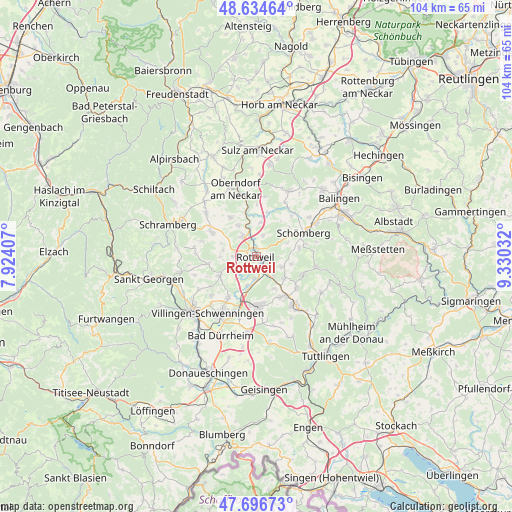
Rottweil GPS coordinates[2]
48° 10' 4.188" North, 8° 37' 37.884" East
| Map corner | latitude | longitude |
|---|---|---|
| Upper-left | 48.63464°, | 7.92407° |
| Center: | 48.16783°, | 8.62719° |
| Lower-right: | 47.69673°, | 9.33032° |
| Map W x H: | 104.3×104.3 km | = 64.8×64.8mi |
| max Lat: | 55.01917° ⇑93.1% North |
| Rottweil: | 48.16783° |
| min Lat: | ⇓6.9% South 47.40724° |
| min Long | Rottweil | max Long |
| 5.92978° | 8.62719° | 14.98853° |
| W 30.1%⇐ | ⇒69.9% E |
Elevation
Elevation of Rottweil is 605 m = 1985 ft, and this is 355.9 m = 1168 ft above average elevation for this country.
| Max E: |
1256 m = 4121 ft | 4.7% |
| Rottweil | 605 m 1985 ft | |
| Avg. | 249.1 m = 817 ft | |
Min E: |
-5 m = -16 ft | 95.3% |
See also: Germany elevation on elevation.city.
Geographical zone
Rottweil is located in North temperate zone (between Tropic of Cancer and the Arctic Circle). Distance of this North polar circle is 2045.4 km =1271 mi to North.| Distance of | km | miles | from Rottweil |
|---|---|---|---|
| North Pole | 4651.3 | 2890.2 | to North |
| Arctic Circle | 2045.4 | 1271 | to North |
| Tropic Cancer | 2749.8 | 1708.6 | to South |
| Equator | 5355.8 | 3327.9 | to South |


Nearby cities:
15 places around Rottweil: (largest is in red/bold)
• Aldingen
9.3 km =5.8 mi,  144°
144°
• Bösingen
9.3 km =5.8 mi,  321°
321°
• Deißlingen
6.3 km =3.9 mi,  193°
193°
• Denkingen
10.4 km =6.5 mi,  127°
127°
• Dietingen
4.4 km =2.7 mi,  21°
21°
• Dunningen
10.2 km =6.3 mi,  298°
298°
• Epfendorf
9.4 km =5.8 mi,  347°
347°
• Frittlingen
7.5 km =4.7 mi, 127°
• Gosheim
10.1 km =6.3 mi,  111°
111°
• Niedereschach
7.9 km =4.9 mi,  241°
241°
• Trossingen
10.2 km =6.3 mi,  172°
172°
• Villingendorf
4.8 km =3 mi, 317°
• Wellendingen
6.1 km =3.8 mi, 111°
• Zimmern ob Rottweil
2.4 km =1.5 mi,  266°
266°
• Zimmern unter der Burg
9 km =5.6 mi,  49°
49°
Sources, notices
• [Note1] Compared only with cities in Germany existing in our database
• [Src1] Map data: © OpenStreetMap contributors (CC-BY-SA)
• [Src2] Other city data from geonames.org with taken over terms of usage.
• [Src3] Geographical zone / Annual Mean Temperature by Robert A. Rohde @ Wikipedia
