Weißenbrunn geodata
Weißenbrunn (Bavaria) is a seat of a fourth-order administrative division; located in Germany in Europe/Berlin (GMT+2) time zone. With population of 3,110 people, there are 3908 cities with bigger population in this country. Compared to other cities in Germany, 59% of cities are located further ↑North; 72% of cities are located further ←West and 66.4% of cities have lower elevation than Weißenbrunn. Note1
Administrative division(s):
- Level 1: Bavaria
- Level 2: Upper Franconia
- Level 3: Landkreis Kronach
- Level 4: Weißenbrunn


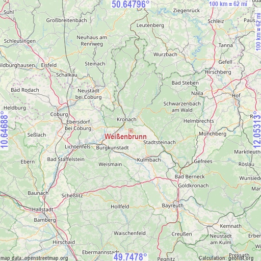
Weißenbrunn GPS coordinates[2]
50° 12' 0" North, 11° 21' 0" East
| Map corner | latitude | longitude |
|---|---|---|
| Upper-left | 50.64796°, | 10.64688° |
| Center: | 50.2°, | 11.35° |
| Lower-right: | 49.7478°, | 12.05313° |
| Map W x H: | 100.1×100.1 km | = 62.2×62.2mi |
| max Lat: | 55.01917° ⇑59% North |
| Weißenbrunn: | 50.2° |
| min Lat: | ⇓41% South 47.40724° |
| min Long | Weißenbrunn | max Long |
| 5.92978° | 11.35° | 14.98853° |
| W 72%⇐ | ⇒28% E |
Elevation
Elevation of Weißenbrunn is 331 m = 1086 ft, and this is 81.9 m = 269 ft above average elevation for this country.
| Max E: |
1256 m = 4121 ft | 33.6% |
| Weißenbrunn | 331 m 1086 ft | |
| Avg. | 249.1 m = 817 ft | |
Min E: |
-5 m = -16 ft | 66.4% |
See also: Germany elevation on elevation.city.
Geographical zone
Weißenbrunn is located in North temperate zone (between Tropic of Cancer and the Arctic Circle). Distance of this North polar circle is 1819.5 km =1130.6 mi to North.| Distance of | km | miles | from Weißenbrunn |
|---|---|---|---|
| North Pole | 4425.3 | 2749.8 | to North |
| Arctic Circle | 1819.5 | 1130.6 | to North |
| Tropic Cancer | 2975.8 | 1849.1 | to South |
| Equator | 5581.7 | 3468.3 | to South |


Nearby cities:
15 places around Weißenbrunn: (largest is in red/bold)
• Altenkunstadt
10.9 km =6.8 mi,  220°
220°
• Burgkunstadt
9.6 km =6 mi,  226°
226°
• Kronach
4.6 km =2.9 mi,  344°
344°
• Kueps Oberfranken
5.3 km =3.3 mi,  261°
261°
• Mainleus
11.3 km =7 mi,  170°
170°
• Marktgraitz
11.2 km =7 mi, 260°
• Marktrodach
6 km =3.7 mi,  23°
23°
• Mitwitz
11.6 km =7.2 mi,  299°
299°
• Redwitz an der Rodach
10.5 km =6.5 mi,  253°
253°
• Reichenbach
11.7 km =7.3 mi,  65°
65°
• Rugendorf
8.3 km =5.2 mi,  90°
90°
• Schneckenlohe
11.2 km =7 mi,  276°
276°
• Stadtsteinach
11.6 km =7.2 mi,  109°
109°
• Wallenfels
11.5 km =7.1 mi,  48°
48°
• Wilhelmsthal
12.5 km =7.8 mi,  7°
7°
Sources, notices
• [Note1] Compared only with cities in Germany existing in our database
• [Src1] Map data: © OpenStreetMap contributors (CC-BY-SA)
• [Src2] Other city data from geonames.org with taken over terms of usage.
• [Src3] Geographical zone / Annual Mean Temperature by Robert A. Rohde @ Wikipedia
