Wilhelmsthal geodata
Wilhelmsthal (Bavaria) is a seat of a fourth-order administrative division; located in Germany in Europe/Berlin (GMT+2) time zone. With population of 4,123 people, there are 3210 cities with bigger population in this country. Compared to other cities in Germany, 56.6% of cities are located further ↑North; 72.4% of cities are located further ←West and 84.3% of cities have lower elevation than Wilhelmsthal. Note1
Administrative division(s):
- Level 1: Bavaria
- Level 2: Upper Franconia
- Level 3: Landkreis Kronach
- Level 4: Wilhelmsthal


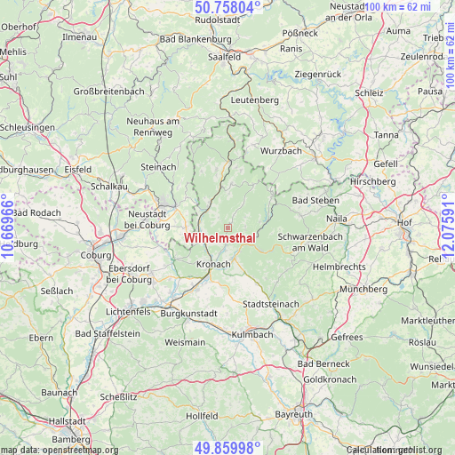
Wilhelmsthal GPS coordinates[2]
50° 18' 40.068" North, 11° 22' 22.008" East
| Map corner | latitude | longitude |
|---|---|---|
| Upper-left | 50.75804°, | 10.66966° |
| Center: | 50.31113°, | 11.37278° |
| Lower-right: | 49.85998°, | 12.07591° |
| Map W x H: | 99.9×99.9 km | = 62.1×62.1mi |
| max Lat: | 55.01917° ⇑56.6% North |
| Wilhelmsthal: | 50.31113° |
| min Lat: | ⇓43.4% South 47.40724° |
| min Long | Wilhelmsthal | max Long |
| 5.92978° | 11.37278° | 14.98853° |
| W 72.4%⇐ | ⇒27.6% E |
Elevation
Elevation of Wilhelmsthal is 463 m = 1519 ft, and this is 213.9 m = 702 ft above average elevation for this country.
| Max E: |
1256 m = 4121 ft | 15.7% |
| Wilhelmsthal | 463 m 1519 ft | |
| Avg. | 249.1 m = 817 ft | |
Min E: |
-5 m = -16 ft | 84.3% |
See also: Germany elevation on elevation.city.
Geographical zone
Wilhelmsthal is located in North temperate zone (between Tropic of Cancer and the Arctic Circle). Distance of this North polar circle is 1807.1 km =1122.9 mi to North.| Distance of | km | miles | from Wilhelmsthal |
|---|---|---|---|
| North Pole | 4413 | 2742.1 | to North |
| Arctic Circle | 1807.1 | 1122.9 | to North |
| Tropic Cancer | 2988.2 | 1856.8 | to South |
| Equator | 5594.1 | 3476 | to South |


Nearby cities:
15 places around Wilhelmsthal: (largest is in red/bold)
• Föritz
10.6 km =6.6 mi,  288°
288°
• Kronach
8.4 km =5.2 mi,  199°
199°
• Marktrodach
6.8 km =4.2 mi,  173°
173°
• Mitwitz
13.5 km =8.4 mi,  240°
240°
• Neuhaus-Schierschnitz
9.4 km =5.8 mi,  270°
270°
• Nordhalben
12 km =7.5 mi,  54°
54°
• Pressig
6.4 km =4 mi,  315°
315°
• Reichenbach
11.8 km =7.3 mi,  130°
130°
• Reichenbach
12.9 km =8 mi,  12°
12°
• Steinwiesen
6.7 km =4.2 mi,  106°
106°
• Stockheim
6.5 km =4 mi, 265°
• Teuschnitz
9.7 km =6 mi,  4°
4°
• Tschirn
11.3 km =7 mi,  29°
29°
• Wallenfels
8.4 km =5.2 mi,  124°
124°
• Weißenbrunn
12.5 km =7.8 mi,  187°
187°
Sources, notices
• [Note1] Compared only with cities in Germany existing in our database
• [Src1] Map data: © OpenStreetMap contributors (CC-BY-SA)
• [Src2] Other city data from geonames.org with taken over terms of usage.
• [Src3] Geographical zone / Annual Mean Temperature by Robert A. Rohde @ Wikipedia
