Wallscheid geodata
Wallscheid (Rheinland-Pfalz) is a seat of a fourth-order administrative division; located in Germany in Europe/Berlin (GMT+2) time zone. With population of 366 people, there are 9806 cities with bigger population in this country. Compared to other cities in Germany, 61.4% of cities are located further ↑North; 94.8% of cities are located further →East and 81.9% of cities have lower elevation than Wallscheid. Note1
Administrative division(s):
- Level 1: Rheinland-Pfalz
- Level 3: Landkreis Bernkastel-Wittlich
- Level 4: Wallscheid


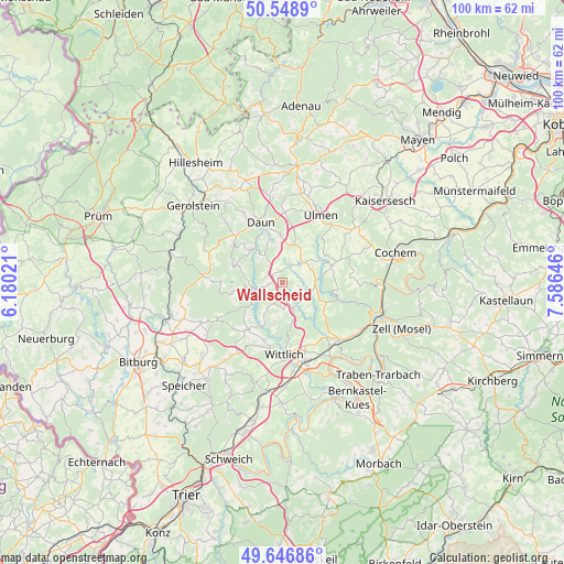
Wallscheid GPS coordinates[2]
50° 6' 0" North, 6° 52' 59.988" East
| Map corner | latitude | longitude |
|---|---|---|
| Upper-left | 50.5489°, | 6.18021° |
| Center: | 50.1°, | 6.88333° |
| Lower-right: | 49.64686°, | 7.58646° |
| Map W x H: | 100.3×100.3 km | = 62.3×62.3mi |
| max Lat: | 55.01917° ⇑61.4% North |
| Wallscheid: | 50.1° |
| min Lat: | ⇓38.6% South 47.40724° |
| min Long | Wallscheid | max Long |
| 5.92978° | 6.88333° | 14.98853° |
| W 5.2%⇐ | ⇒94.8% E |
Elevation
Elevation of Wallscheid is 445 m = 1460 ft, and this is 195.9 m = 643 ft above average elevation for this country.
| Max E: |
1256 m = 4121 ft | 18.1% |
| Wallscheid | 445 m 1460 ft | |
| Avg. | 249.1 m = 817 ft | |
Min E: |
-5 m = -16 ft | 81.9% |
See also: Germany elevation on elevation.city.
Geographical zone
Wallscheid is located in North temperate zone (between Tropic of Cancer and the Arctic Circle). Distance of this North polar circle is 1830.6 km =1137.5 mi to North.| Distance of | km | miles | from Wallscheid |
|---|---|---|---|
| North Pole | 4436.5 | 2756.7 | to North |
| Arctic Circle | 1830.6 | 1137.5 | to North |
| Tropic Cancer | 2964.7 | 1842.2 | to South |
| Equator | 5570.6 | 3461.4 | to South |


Nearby cities:
15 places around Wallscheid: (largest is in red/bold)
• Brockscheid
4.4 km =2.7 mi,  327°
327°
• Dierfeld
1.9 km =1.2 mi,  180°
180°
• Eckfeld
3 km =1.9 mi,  307°
307°
• Gillenfeld
3.4 km =2.1 mi,  25°
25°
• Laufeld
2.2 km =1.4 mi,  212°
212°
• Manderscheid
5.3 km =3.3 mi,  266°
266°
• Mückeln
3 km =1.9 mi,  127°
127°
• Niederöfflingen
3.7 km =2.3 mi, 180°
• Oberscheidweiler
4 km =2.5 mi,  117°
117°
• Oberöfflingen
3.9 km =2.4 mi,  197°
197°
• Pantenburg
4 km =2.5 mi,  242°
242°
• Saxler
3.9 km =2.4 mi,  17°
17°
• Strohn
3 km =1.9 mi,  52°
52°
• Strotzbüsch
4.8 km =3 mi,  90°
90°
• Udler
3.7 km =2.3 mi,  0°
0°
Sources, notices
• [Note1] Compared only with cities in Germany existing in our database
• [Src1] Map data: © OpenStreetMap contributors (CC-BY-SA)
• [Src2] Other city data from geonames.org with taken over terms of usage.
• [Src3] Geographical zone / Annual Mean Temperature by Robert A. Rohde @ Wikipedia
