Üxheim geodata
Üxheim (Rheinland-Pfalz) is a seat of a fourth-order administrative division; located in Germany in Europe/Berlin (GMT+2) time zone. With population of 1,399 people, there are 6081 cities with bigger population in this country. Compared to other cities in Germany, 55.7% of cities are located further ↑North; 96.1% of cities are located further →East and 81.4% of cities have lower elevation than Üxheim. Note1


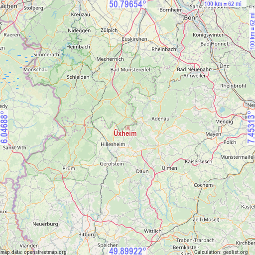
Üxheim GPS coordinates[2]
50° 21' 0" North, 6° 45' 0" East
| Map corner | latitude | longitude |
|---|---|---|
| Upper-left | 50.79654°, | 6.04688° |
| Center: | 50.35°, | 6.75° |
| Lower-right: | 49.89922°, | 7.45313° |
| Map W x H: | 99.8×99.8 km | = 62×62mi |
| max Lat: | 55.01917° ⇑55.7% North |
| Üxheim: | 50.35° |
| min Lat: | ⇓44.3% South 47.40724° |
| min Long | Üxheim | max Long |
| 5.92978° | 6.75° | 14.98853° |
| W 3.9%⇐ | ⇒96.1% E |
Elevation
Elevation of Üxheim is 443 m = 1453 ft, and this is 193.9 m = 636 ft above average elevation for this country.
| Max E: |
1256 m = 4121 ft | 18.6% |
| Üxheim | 443 m 1453 ft | |
| Avg. | 249.1 m = 817 ft | |
Min E: |
-5 m = -16 ft | 81.4% |
See also: Germany elevation on elevation.city.
Geographical zone
Üxheim is located in North temperate zone (between Tropic of Cancer and the Arctic Circle). Distance of this North polar circle is 1802.8 km =1120.2 mi to North.| Distance of | km | miles | from Üxheim |
|---|---|---|---|
| North Pole | 4408.7 | 2739.4 | to North |
| Arctic Circle | 1802.8 | 1120.2 | to North |
| Tropic Cancer | 2992.5 | 1859.5 | to South |
| Equator | 5598.4 | 3478.7 | to South |


Nearby cities:
15 places around Üxheim: (largest is in red/bold)
• Antweiler
8.1 km =5 mi,  46°
46°
• Berndorf
6.3 km =3.9 mi,  217°
217°
• Bodenbach
8 km =5 mi,  117°
117°
• Borler
7 km =4.3 mi, 122°
• Dankerath
5.1 km =3.2 mi,  111°
111°
• Dorsel
5.1 km =3.2 mi,  43°
43°
• Hoffeld
5.1 km =3.2 mi,  68°
68°
• Müsch
7 km =4.3 mi,  57°
57°
• Nohn
3 km =1.9 mi,  128°
128°
• Oberehe-Stroheich
7.5 km =4.7 mi,  170°
170°
• Pomster
6.6 km =4.1 mi,  86°
86°
• Senscheid
6.2 km =3.9 mi, 107°
• Trierscheid
4.7 km =2.9 mi, 90°
• Walsdorf
7.8 km =4.8 mi,  197°
197°
• Wiesbaum
5.5 km =3.4 mi,  259°
259°
Sources, notices
• [Note1] Compared only with cities in Germany existing in our database
• [Src1] Map data: © OpenStreetMap contributors (CC-BY-SA)
• [Src2] Other city data from geonames.org with taken over terms of usage.
• [Src3] Geographical zone / Annual Mean Temperature by Robert A. Rohde @ Wikipedia
