Unterkatz geodata
Unterkatz (Thuringia) is a seat of a fourth-order administrative division; located in Germany in Europe/Berlin (GMT+2) time zone. With population of 437 people, there are 9580 cities with bigger population in this country. Compared to other cities in Germany, 50% of cities are located further ↓South; 54.5% of cities are located further ←West and 75.2% of cities have lower elevation than Unterkatz. Note1
Administrative division(s):
- Level 1: Thuringia
- Level 3: Landkreis Schmalkalden-Meiningen
- Level 4: Wasungen


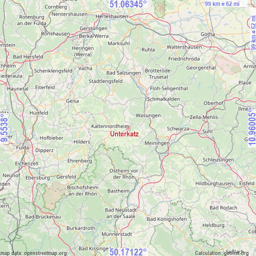
Unterkatz GPS coordinates[2]
50° 37' 10.02" North, 10° 15' 24.912" East
| Map corner | latitude | longitude |
|---|---|---|
| Upper-left | 51.06345°, | 9.5538° |
| Center: | 50.61945°, | 10.25692° |
| Lower-right: | 50.17122°, | 10.96005° |
| Map W x H: | 99.2×99.2 km | = 61.6×61.6mi |
| max Lat: | 55.01917° ⇑50% North |
| Unterkatz: | 50.61945° |
| min Lat: | ⇓50% South 47.40724° |
| min Long | Unterkatz | max Long |
| 5.92978° | 10.25692° | 14.98853° |
| W 54.5%⇐ | ⇒45.5% E |
Elevation
Elevation of Unterkatz is 399 m = 1309 ft, and this is 149.9 m = 492 ft above average elevation for this country.
| Max E: |
1256 m = 4121 ft | 24.8% |
| Unterkatz | 399 m 1309 ft | |
| Avg. | 249.1 m = 817 ft | |
Min E: |
-5 m = -16 ft | 75.2% |
See also: Germany elevation on elevation.city.
Geographical zone
Unterkatz is located in North temperate zone (between Tropic of Cancer and the Arctic Circle). Distance of this North polar circle is 1772.8 km =1101.6 mi to North.| Distance of | km | miles | from Unterkatz |
|---|---|---|---|
| North Pole | 4378.7 | 2720.8 | to North |
| Arctic Circle | 1772.8 | 1101.6 | to North |
| Tropic Cancer | 3022.4 | 1878 | to South |
| Equator | 5628.4 | 3497.3 | to South |


Nearby cities:
15 places around Unterkatz: (largest is in red/bold)
• Aschenhausen
4.6 km =2.9 mi,  241°
241°
• Friedelshausen
4.5 km =2.8 mi,  341°
341°
• Herpf
7.1 km =4.4 mi,  130°
130°
• Hümpfershausen
5.5 km =3.4 mi, 342°
• Kaltenlengsfeld
5.2 km =3.2 mi,  297°
297°
• Kaltennordheim
6.9 km =4.3 mi,  276°
276°
• Kaltensundheim
7.2 km =4.5 mi,  258°
258°
• Mehmels
5.6 km =3.5 mi,  74°
74°
• Oberkatz
2.7 km =1.7 mi,  217°
217°
• Oepfershausen
2.7 km =1.7 mi,  334°
334°
• Rippershausen
6.9 km =4.3 mi,  108°
108°
• Stepfershausen
3.7 km =2.3 mi, 125°
• Wahns
3.4 km =2.1 mi,  63°
63°
• Walldorf
8.9 km =5.5 mi,  91°
91°
• Wasungen
9.2 km =5.7 mi, 59°
Sources, notices
• [Note1] Compared only with cities in Germany existing in our database
• [Src1] Map data: © OpenStreetMap contributors (CC-BY-SA)
• [Src2] Other city data from geonames.org with taken over terms of usage.
• [Src3] Geographical zone / Annual Mean Temperature by Robert A. Rohde @ Wikipedia
