Süderhackstedt geodata
Süderhackstedt (Schleswig-Holstein) is a seat of a fourth-order administrative division; located in Germany in Europe/Berlin (GMT+2) time zone. With population of 357 people, there are 9842 cities with bigger population in this country. Compared to other cities in Germany, 98.5% of cities are located further ↓South; 61% of cities are located further →East and 94.3% of cities have higher elevation than Süderhackstedt. Note1
Administrative division(s):
- Level 1: Schleswig-Holstein
- Level 3: Kreis Schleswig-Flensburg
- Level 4: Süderhackstedt


Süderhackstedt GPS coordinates[2]
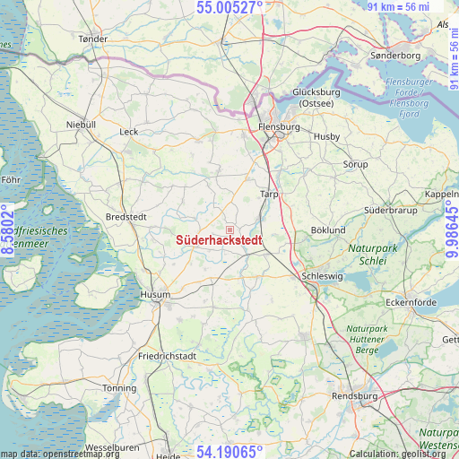
54° 36' 0" North, 9° 16' 59.988" East
| Map corner | latitude | longitude |
|---|---|---|
| Upper-left | 55.00527°, | 8.5802° |
| Center: | 54.6°, | 9.28333° |
| Lower-right: | 54.19065°, | 9.98645° |
| Map W x H: | 90.6×90.6 km | = 56.3×56.3mi |
| max Lat: | 55.01917° ⇑1.5% North |
| Süderhackstedt: | 54.6° |
| min Lat: | ⇓98.5% South 47.40724° |
| min Long | Süderhackstedt | max Long |
| 5.92978° | 9.28333° | 14.98853° |
| W 39%⇐ | ⇒61% E |
Elevation
Elevation of Süderhackstedt is 10 m = 33 ft, and this is 239.1 m = 784 ft below average elevation for this country.
| Max E: |
1256 m = 4121 ft | 94.3% |
| Avg. | 249.1 m = 817 ft | |
| Süderhackstedt | 10 m = 33 ft | |
Min E: |
-5 m = -16 ft | 5.7% |
See also: Germany elevation on elevation.city.
Geographical zone
Süderhackstedt is located in North temperate zone (between Tropic of Cancer and the Arctic Circle). Distance of this North polar circle is 1330.2 km =826.5 mi to North.| Distance of | km | miles | from Süderhackstedt |
|---|---|---|---|
| North Pole | 3936.1 | 2445.8 | to North |
| Arctic Circle | 1330.2 | 826.5 | to North |
| Tropic Cancer | 3465 | 2153.1 | to South |
| Equator | 6071 | 3772.3 | to South |


Nearby cities:
15 places around Süderhackstedt: (largest is in red/bold)
• Ahrenviöl
9.1 km =5.7 mi,  212°
212°
• Behrendorf
5.7 km =3.5 mi,  229°
229°
• Bollingstedt
8.7 km =5.4 mi,  95°
95°
• Bondelum
3.9 km =2.4 mi,  196°
196°
• Eggebek
5.7 km =3.5 mi,  70°
70°
• Haselund
6.4 km =4 mi,  270°
270°
• Janneby
3.9 km =2.4 mi,  16°
16°
• Jerrishoe
8.4 km =5.2 mi,  41°
41°
• Jörl
1.1 km =0.7 mi,  90°
90°
• Jübek
8.8 km =5.5 mi,  122°
122°
• Langstedt
6.7 km =4.2 mi, 73°
• Löwenstedt
7.5 km =4.7 mi,  288°
288°
• Sollerup
2.8 km =1.7 mi,  130°
130°
• Sollwitt
4.3 km =2.7 mi, 270°
• Viöl
7.4 km =4.6 mi,  240°
240°
Sources, notices
• [Note1] Compared only with cities in Germany existing in our database
• [Src1] Map data: © OpenStreetMap contributors (CC-BY-SA)
• [Src2] Other city data from geonames.org with taken over terms of usage.
• [Src3] Geographical zone / Annual Mean Temperature by Robert A. Rohde @ Wikipedia
