Sollerup geodata
Sollerup (Schleswig-Holstein) is a seat of a fourth-order administrative division; located in Germany in Europe/Berlin (GMT+2) time zone. With population of 462 people, there are 9500 cities with bigger population in this country. Compared to other cities in Germany, 98.4% of cities are located further ↓South; 60.6% of cities are located further →East and 95.2% of cities have higher elevation than Sollerup. Note1
Administrative division(s):
- Level 1: Schleswig-Holstein
- Level 3: Kreis Schleswig-Flensburg
- Level 4: Sollerup


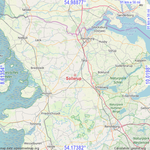
Sollerup GPS coordinates[2]
54° 34' 59.988" North, 9° 19' 0.012" East
| Map corner | latitude | longitude |
|---|---|---|
| Upper-left | 54.98877°, | 8.61354° |
| Center: | 54.58333°, | 9.31667° |
| Lower-right: | 54.17382°, | 10.0198° |
| Map W x H: | 90.6×90.6 km | = 56.3×56.3mi |
| max Lat: | 55.01917° ⇑1.6% North |
| Sollerup: | 54.58333° |
| min Lat: | ⇓98.4% South 47.40724° |
| min Long | Sollerup | max Long |
| 5.92978° | 9.31667° | 14.98853° |
| W 39.4%⇐ | ⇒60.6% E |
Elevation
Elevation of Sollerup is 8 m = 26 ft, and this is 241.1 m = 791 ft below average elevation for this country.
| Max E: |
1256 m = 4121 ft | 95.2% |
| Avg. | 249.1 m = 817 ft | |
| Sollerup | 8 m = 26 ft | |
Min E: |
-5 m = -16 ft | 4.8% |
See also: Germany elevation on elevation.city.
Geographical zone
Sollerup is located in North temperate zone (between Tropic of Cancer and the Arctic Circle). Distance of this North polar circle is 1332.1 km =827.7 mi to North.| Distance of | km | miles | from Sollerup |
|---|---|---|---|
| North Pole | 3938 | 2447 | to North |
| Arctic Circle | 1332.1 | 827.7 | to North |
| Tropic Cancer | 3463.2 | 2151.9 | to South |
| Equator | 6069.1 | 3771.2 | to South |


Nearby cities:
15 places around Sollerup: (largest is in red/bold)
• Ahrenviöl
9.1 km =5.7 mi,  230°
230°
• Behrendorf
6.7 km =4.2 mi,  253°
253°
• Bollingstedt
6.6 km =4.1 mi,  81°
81°
• Bondelum
3.7 km =2.3 mi,  240°
240°
• Eggebek
4.9 km =3 mi,  40°
40°
• Haselund
8.8 km =5.5 mi,  282°
282°
• Janneby
5.7 km =3.5 mi,  349°
349°
• Jerrishoe
8.8 km =5.5 mi,  22°
22°
• Jörl
2.1 km =1.3 mi,  329°
329°
• Jübek
6 km =3.7 mi,  119°
119°
• Langstedt
5.7 km =3.5 mi,  49°
49°
• Silberstedt
8.6 km =5.3 mi,  149°
149°
• Sollwitt
6.7 km =4.2 mi,  286°
286°
• Süderhackstedt
2.8 km =1.7 mi,  310°
310°
• Viöl
8.8 km =5.5 mi,  257°
257°
Sources, notices
• [Note1] Compared only with cities in Germany existing in our database
• [Src1] Map data: © OpenStreetMap contributors (CC-BY-SA)
• [Src2] Other city data from geonames.org with taken over terms of usage.
• [Src3] Geographical zone / Annual Mean Temperature by Robert A. Rohde @ Wikipedia
