Stemshorn geodata
Stemshorn (Lower Saxony) is a seat of a fourth-order administrative division; located in Germany in Europe/Berlin (GMT+2) time zone. With population of 739 people, there are 8157 cities with bigger population in this country. Compared to other cities in Germany, 76.9% of cities are located further ↓South; 72.2% of cities are located further →East and 77.5% of cities have higher elevation than Stemshorn. Note1


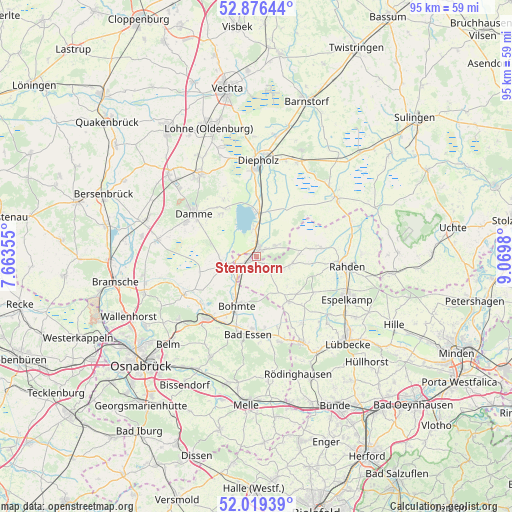
Stemshorn GPS coordinates[2]
52° 27' 0" North, 8° 22' 0.012" East
| Map corner | latitude | longitude |
|---|---|---|
| Upper-left | 52.87644°, | 7.66355° |
| Center: | 52.45°, | 8.36667° |
| Lower-right: | 52.01939°, | 9.0698° |
| Map W x H: | 95.3×95.3 km | = 59.2×59.2mi |
| max Lat: | 55.01917° ⇑23.1% North |
| Stemshorn: | 52.45° |
| min Lat: | ⇓76.9% South 47.40724° |
| min Long | Stemshorn | max Long |
| 5.92978° | 8.36667° | 14.98853° |
| W 27.8%⇐ | ⇒72.2% E |
Elevation
Elevation of Stemshorn is 54 m = 177 ft, and this is 195.1 m = 640 ft below average elevation for this country.
| Max E: |
1256 m = 4121 ft | 77.5% |
| Avg. | 249.1 m = 817 ft | |
| Stemshorn | 54 m = 177 ft | |
Min E: |
-5 m = -16 ft | 22.5% |
See also: Germany elevation on elevation.city.
Geographical zone
Stemshorn is located in North temperate zone (between Tropic of Cancer and the Arctic Circle). Distance of this North polar circle is 1569.3 km =975.1 mi to North.| Distance of | km | miles | from Stemshorn |
|---|---|---|---|
| North Pole | 4175.2 | 2594.3 | to North |
| Arctic Circle | 1569.3 | 975.1 | to North |
| Tropic Cancer | 3226 | 2004.5 | to South |
| Equator | 5831.9 | 3623.8 | to South |


Nearby cities:
15 places around Stemshorn: (largest is in red/bold)
• Bad Essen
15 km =9.3 mi,  188°
188°
• Bohmte
9.9 km =6.2 mi,  200°
200°
• Brockum
3.9 km =2.4 mi,  61°
61°
• Damme
13.9 km =8.6 mi,  304°
304°
• Diepholz
17.6 km =10.9 mi,  0°
0°
• Huede
5.1 km =3.2 mi,  353°
353°
• Laar
13 km =8.1 mi,  216°
216°
• Lembruch
9.3 km =5.8 mi, 353°
• Lemförde
1.8 km =1.1 mi,  20°
20°
• Marl
3.7 km =2.3 mi, 0°
• Ostercappeln
14.3 km =8.9 mi, 219°
• Preußisch Oldendorf
18.2 km =11.3 mi,  151°
151°
• Quernheim
2.9 km =1.8 mi,  50°
50°
• Rahden
16.8 km =10.4 mi,  96°
96°
• Steinfeld
18.3 km =11.4 mi,  325°
325°
Sources, notices
• [Note1] Compared only with cities in Germany existing in our database
• [Src1] Map data: © OpenStreetMap contributors (CC-BY-SA)
• [Src2] Other city data from geonames.org with taken over terms of usage.
• [Src3] Geographical zone / Annual Mean Temperature by Robert A. Rohde @ Wikipedia
