Spirkelbach geodata
Spirkelbach (Rheinland-Pfalz) is a seat of a fourth-order administrative division; located in Germany in Europe/Berlin (GMT+2) time zone. With population of 709 people, there are 8274 cities with bigger population in this country. Compared to other cities in Germany, 80.3% of cities are located further ↑North; 79.4% of cities are located further →East and 51.3% of cities have lower elevation than Spirkelbach. Note1


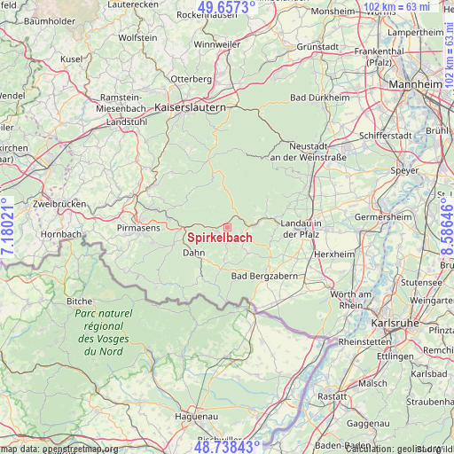
Spirkelbach GPS coordinates[2]
49° 12' 0" North, 7° 52' 59.988" East
| Map corner | latitude | longitude |
|---|---|---|
| Upper-left | 49.6573°, | 7.18021° |
| Center: | 49.2°, | 7.88333° |
| Lower-right: | 48.73843°, | 8.58646° |
| Map W x H: | 102.2×102.2 km | = 63.5×63.5mi |
| max Lat: | 55.01917° ⇑80.3% North |
| Spirkelbach: | 49.2° |
| min Lat: | ⇓19.7% South 47.40724° |
| min Long | Spirkelbach | max Long |
| 5.92978° | 7.88333° | 14.98853° |
| W 20.6%⇐ | ⇒79.4% E |
Elevation
Elevation of Spirkelbach is 235 m = 771 ft, and this is 14.1 m = 46 ft below average elevation for this country.
| Max E: |
1256 m = 4121 ft | 48.7% |
| Avg. | 249.1 m = 817 ft | |
| Spirkelbach | 235 m = 771 ft | |
Min E: |
-5 m = -16 ft | 51.3% |
See also: Germany elevation on elevation.city.
Geographical zone
Spirkelbach is located in North temperate zone (between Tropic of Cancer and the Arctic Circle). Distance of this North polar circle is 1930.6 km =1199.6 mi to North.| Distance of | km | miles | from Spirkelbach |
|---|---|---|---|
| North Pole | 4536.5 | 2818.8 | to North |
| Arctic Circle | 1930.6 | 1199.6 | to North |
| Tropic Cancer | 2864.6 | 1780 | to South |
| Equator | 5470.5 | 3399.2 | to South |


Nearby cities:
15 places around Spirkelbach: (largest is in red/bold)
• Annweiler am Trifels
6.7 km =4.2 mi,  84°
84°
• Darstein
5.6 km =3.5 mi,  180°
180°
• Dimbach
3.9 km =2.4 mi,  161°
161°
• Erfweiler
7 km =4.3 mi,  227°
227°
• Gossersweiler-Stein
6.6 km =4.1 mi,  146°
146°
• Hauenstein
2.2 km =1.4 mi,  246°
246°
• Lug
2.2 km =1.4 mi, 146°
• Oberschlettenbach
6 km =3.7 mi,  187°
187°
• Rinnthal
3 km =1.9 mi,  52°
52°
• Schwanheim
3.7 km =2.3 mi, 180°
• Silz
7.4 km =4.6 mi,  138°
138°
• Völkersweiler
5.2 km =3.2 mi, 135°
• Waldrohrbach
7.1 km =4.4 mi,  121°
121°
• Wernersberg
3.4 km =2.1 mi,  107°
107°
• Wilgartswiesen
1.2 km =0.7 mi,  324°
324°
Sources, notices
• [Note1] Compared only with cities in Germany existing in our database
• [Src1] Map data: © OpenStreetMap contributors (CC-BY-SA)
• [Src2] Other city data from geonames.org with taken over terms of usage.
• [Src3] Geographical zone / Annual Mean Temperature by Robert A. Rohde @ Wikipedia
