Selchenbach geodata
Selchenbach (Rheinland-Pfalz) is a seat of a fourth-order administrative division; located in Germany in Europe/Berlin (GMT+2) time zone. With population of 396 people, there are 9703 cities with bigger population in this country. Compared to other cities in Germany, 75.7% of cities are located further ↑North; 90% of cities are located further →East and 72.6% of cities have lower elevation than Selchenbach. Note1


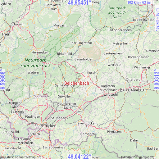
Selchenbach GPS coordinates[2]
49° 30' 0" North, 7° 18' 0" East
| Map corner | latitude | longitude |
|---|---|---|
| Upper-left | 49.95451°, | 6.59688° |
| Center: | 49.5°, | 7.3° |
| Lower-right: | 49.04122°, | 8.00313° |
| Map W x H: | 101.5×101.5 km | = 63.1×63.1mi |
| max Lat: | 55.01917° ⇑75.7% North |
| Selchenbach: | 49.5° |
| min Lat: | ⇓24.3% South 47.40724° |
| min Long | Selchenbach | max Long |
| 5.92978° | 7.3° | 14.98853° |
| W 10%⇐ | ⇒90% E |
Elevation
Elevation of Selchenbach is 379 m = 1243 ft, and this is 129.9 m = 426 ft above average elevation for this country.
| Max E: |
1256 m = 4121 ft | 27.4% |
| Selchenbach | 379 m 1243 ft | |
| Avg. | 249.1 m = 817 ft | |
Min E: |
-5 m = -16 ft | 72.6% |
See also: Germany elevation on elevation.city.
Geographical zone
Selchenbach is located in North temperate zone (between Tropic of Cancer and the Arctic Circle). Distance of this North polar circle is 1897.3 km =1178.9 mi to North.| Distance of | km | miles | from Selchenbach |
|---|---|---|---|
| North Pole | 4503.2 | 2798.2 | to North |
| Arctic Circle | 1897.3 | 1178.9 | to North |
| Tropic Cancer | 2898 | 1800.7 | to South |
| Equator | 5503.9 | 3420 | to South |


Nearby cities:
15 places around Selchenbach: (largest is in red/bold)
• Albessen
3 km =1.9 mi,  52°
52°
• Altenkirchen
6.5 km =4 mi,  166°
166°
• Ehweiler
5.2 km =3.2 mi,  68°
68°
• Freisen
6.6 km =4.1 mi,  327°
327°
• Frohnhofen
5.1 km =3.2 mi,  180°
180°
• Herchweiler
1.6 km =1 mi,  343°
343°
• Herschweiler-Pettersheim
4.1 km =2.5 mi,  117°
117°
• Hüffler
6 km =3.7 mi,  90°
90°
• Konken
4 km =2.5 mi,  75°
75°
• Krottelbach
4.4 km =2.7 mi,  146°
146°
• Langenbach
2.1 km =1.3 mi,  109°
109°
• Ohmbach
6.6 km =4.1 mi, 146°
• Pfeffelbach
4.8 km =3 mi,  24°
24°
• Reichweiler
3.9 km =2.4 mi, 342°
• Wahnwegen
5.8 km =3.6 mi, 107°
Sources, notices
• [Note1] Compared only with cities in Germany existing in our database
• [Src1] Map data: © OpenStreetMap contributors (CC-BY-SA)
• [Src2] Other city data from geonames.org with taken over terms of usage.
• [Src3] Geographical zone / Annual Mean Temperature by Robert A. Rohde @ Wikipedia
