Reichweiler geodata
Reichweiler (Rheinland-Pfalz) is a seat of a fourth-order administrative division; located in Germany in Europe/Berlin (GMT+2) time zone. With population of 565 people, there are 9001 cities with bigger population in this country. Compared to other cities in Germany, 75.2% of cities are located further ↑North; 90.3% of cities are located further →East and 70.7% of cities have lower elevation than Reichweiler. Note1


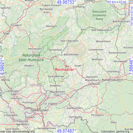
Reichweiler GPS coordinates[2]
49° 31' 59.988" North, 7° 16' 59.988" East
| Map corner | latitude | longitude |
|---|---|---|
| Upper-left | 49.98753°, | 6.58021° |
| Center: | 49.53333°, | 7.28333° |
| Lower-right: | 49.07487°, | 7.98646° |
| Map W x H: | 101.5×101.5 km | = 63.1×63.1mi |
| max Lat: | 55.01917° ⇑75.2% North |
| Reichweiler: | 49.53333° |
| min Lat: | ⇓24.8% South 47.40724° |
| min Long | Reichweiler | max Long |
| 5.92978° | 7.28333° | 14.98853° |
| W 9.7%⇐ | ⇒90.3% E |
Elevation
Elevation of Reichweiler is 364 m = 1194 ft, and this is 114.9 m = 377 ft above average elevation for this country.
| Max E: |
1256 m = 4121 ft | 29.3% |
| Reichweiler | 364 m 1194 ft | |
| Avg. | 249.1 m = 817 ft | |
Min E: |
-5 m = -16 ft | 70.7% |
See also: Germany elevation on elevation.city.
Geographical zone
Reichweiler is located in North temperate zone (between Tropic of Cancer and the Arctic Circle). Distance of this North polar circle is 1893.6 km =1176.6 mi to North.| Distance of | km | miles | from Reichweiler |
|---|---|---|---|
| North Pole | 4499.5 | 2795.9 | to North |
| Arctic Circle | 1893.6 | 1176.6 | to North |
| Tropic Cancer | 2901.7 | 1803 | to South |
| Equator | 5507.6 | 3422.3 | to South |


Nearby cities:
15 places around Reichweiler: (largest is in red/bold)
• Albessen
4.1 km =2.5 mi,  117°
117°
• Eckersweiler
3.7 km =2.3 mi,  0°
0°
• Ehweiler
6.3 km =3.9 mi,  107°
107°
• Fohren-Linden
5.6 km =3.5 mi, 0°
• Freisen
3 km =1.9 mi,  307°
307°
• Hahnweiler
6.1 km =3.8 mi, 307°
• Herchweiler
2.3 km =1.4 mi,  161°
161°
• Konken
5.8 km =3.6 mi, 118°
• Langenbach
5.5 km =3.4 mi,  144°
144°
• Mettweiler
6.1 km =3.8 mi,  23°
23°
• Pfeffelbach
3.3 km =2.1 mi,  77°
77°
• Rohrbach
5.7 km =3.5 mi,  347°
347°
• Ruthweiler
6.3 km =3.9 mi,  72°
72°
• Selchenbach
3.9 km =2.4 mi, 162°
• Thallichtenberg
5.6 km =3.5 mi,  60°
60°
Sources, notices
• [Note1] Compared only with cities in Germany existing in our database
• [Src1] Map data: © OpenStreetMap contributors (CC-BY-SA)
• [Src2] Other city data from geonames.org with taken over terms of usage.
• [Src3] Geographical zone / Annual Mean Temperature by Robert A. Rohde @ Wikipedia
