Seehof geodata
Seehof (Mecklenburg-Vorpommern) is a populated place; located in Germany in Europe/Berlin (GMT+2) time zone. With population of 1,048 people, there are 7013 cities with bigger population in this country. Compared to other cities in Germany, 88.5% of cities are located further ↓South; 73.2% of cities are located further ←West and 78.7% of cities have higher elevation than Seehof. Note1
Administrative division(s):
- Level 1: Mecklenburg-Vorpommern
- Level 3: Nordwestmecklenburg
- Level 4: Seehof


Seehof GPS coordinates[2]
53° 41' 32.964" North, 11° 25' 57.216" East
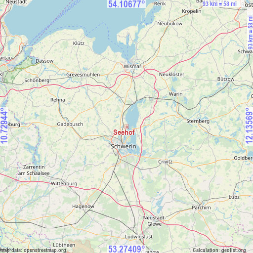
| Map corner | latitude | longitude |
|---|---|---|
| Upper-left | 54.10677°, | 10.72944° |
| Center: | 53.69249°, | 11.43256° |
| Lower-right: | 53.27409°, | 12.13569° |
| Map W x H: | 92.6×92.6 km | = 57.5×57.5mi |
| max Lat: | 55.01917° ⇑11.5% North |
| Seehof: | 53.69249° |
| min Lat: | ⇓88.5% South 47.40724° |
| min Long | Seehof | max Long |
| 5.92978° | 11.43256° | 14.98853° |
| W 73.2%⇐ | ⇒26.8% E |
Elevation
Elevation of Seehof is 51 m = 167 ft, and this is 198.1 m = 650 ft below average elevation for this country.
| Max E: |
1256 m = 4121 ft | 78.7% |
| Avg. | 249.1 m = 817 ft | |
| Seehof | 51 m = 167 ft | |
Min E: |
-5 m = -16 ft | 21.3% |
See also: Germany elevation on elevation.city.
Geographical zone
Seehof is located in North temperate zone (between Tropic of Cancer and the Arctic Circle). Distance of this North polar circle is 1431.1 km =889.2 mi to North.| Distance of | km | miles | from Seehof |
|---|---|---|---|
| North Pole | 4037 | 2508.5 | to North |
| Arctic Circle | 1431.1 | 889.2 | to North |
| Tropic Cancer | 3364.1 | 2090.4 | to South |
| Equator | 5970 | 3709.6 | to South |


Nearby cities:
15 places around Seehof: (largest is in red/bold)
• Altstadt
7.2 km =4.5 mi,  188°
188°
• Cambs
6.2 km =3.9 mi,  85°
85°
• Klein Trebbow
4.5 km =2.8 mi,  297°
297°
• Lankow
6.3 km =3.9 mi,  221°
221°
• Leezen
5.5 km =3.4 mi,  127°
127°
• Lewenberg
5.4 km =3.4 mi,  197°
197°
• Lübstorf
3.9 km =2.4 mi,  342°
342°
• Paulsstadt
6.9 km =4.3 mi, 195°
• Pingelshagen
6.5 km =4 mi,  260°
260°
• Retgendorf
6.2 km =3.9 mi,  48°
48°
• Schelfstadt
6.6 km =4.1 mi, 188°
• Schwerin
7.1 km =4.4 mi, 190°
• Werdervorstadt
5.9 km =3.7 mi,  183°
183°
• Weststadt
6.9 km =4.3 mi, 200°
• Zickhusen
7.5 km =4.7 mi,  350°
350°
Sources, notices
• [Note1] Compared only with cities in Germany existing in our database
• [Src1] Map data: © OpenStreetMap contributors (CC-BY-SA)
• [Src2] Other city data from geonames.org with taken over terms of usage.
• [Src3] Geographical zone / Annual Mean Temperature by Robert A. Rohde @ Wikipedia
