Schadeleben geodata
Schadeleben (Saxony-Anhalt) is a populated place; located in Germany in Europe/Berlin (GMT+2) time zone. With population of 711 people, there are 8269 cities with bigger population in this country. Compared to other cities in Germany, 70.3% of cities are located further ↓South; 72.1% of cities are located further ←West and 64.7% of cities have higher elevation than Schadeleben. Note1


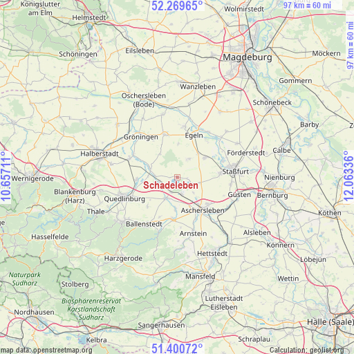
Schadeleben GPS coordinates[2]
51° 50' 14.208" North, 11° 21' 36.828" East
| Map corner | latitude | longitude |
|---|---|---|
| Upper-left | 52.26965°, | 10.65711° |
| Center: | 51.83728°, | 11.36023° |
| Lower-right: | 51.40072°, | 12.06336° |
| Map W x H: | 96.6×96.6 km | = 60×60mi |
| max Lat: | 55.01917° ⇑29.7% North |
| Schadeleben: | 51.83728° |
| min Lat: | ⇓70.3% South 47.40724° |
| min Long | Schadeleben | max Long |
| 5.92978° | 11.36023° | 14.98853° |
| W 72.1%⇐ | ⇒27.9% E |
Elevation
Elevation of Schadeleben is 122 m = 400 ft, and this is 127.1 m = 417 ft below average elevation for this country.
| Max E: |
1256 m = 4121 ft | 64.7% |
| Avg. | 249.1 m = 817 ft | |
| Schadeleben | 122 m = 400 ft | |
Min E: |
-5 m = -16 ft | 35.3% |
See also: Germany elevation on elevation.city.
Geographical zone
Schadeleben is located in North temperate zone (between Tropic of Cancer and the Arctic Circle). Distance of this North polar circle is 1637.4 km =1017.4 mi to North.| Distance of | km | miles | from Schadeleben |
|---|---|---|---|
| North Pole | 4243.3 | 2636.7 | to North |
| Arctic Circle | 1637.4 | 1017.4 | to North |
| Tropic Cancer | 3157.8 | 1962.2 | to South |
| Equator | 5763.8 | 3581.5 | to South |


Nearby cities:
15 places around Schadeleben: (largest is in red/bold)
• Aschersleben
11.3 km =7 mi,  142°
142°
• Cochstedt
6.1 km =3.8 mi,  34°
34°
• Ditfurt
11 km =6.8 mi,  267°
267°
• Frose
4.8 km =3 mi,  164°
164°
• Gatersleben
5.3 km =3.3 mi,  251°
251°
• Groß Börnecke
9.2 km =5.7 mi,  55°
55°
• Hakeborn
9 km =5.6 mi,  2°
2°
• Hausneindorf
6.1 km =3.8 mi, 272°
• Hedersleben
8 km =5 mi,  288°
288°
• Hoym
6.9 km =4.3 mi,  208°
208°
• Nachterstedt
4.4 km =2.7 mi,  203°
203°
• Schneidlingen
8.6 km =5.3 mi,  42°
42°
• Wedderstedt
8 km =5 mi, 271°
• Wilsleben
6.1 km =3.8 mi,  132°
132°
• Winningen
6.4 km =4 mi,  104°
104°
Sources, notices
• [Note1] Compared only with cities in Germany existing in our database
• [Src1] Map data: © OpenStreetMap contributors (CC-BY-SA)
• [Src2] Other city data from geonames.org with taken over terms of usage.
• [Src3] Geographical zone / Annual Mean Temperature by Robert A. Rohde @ Wikipedia
