Schacht-Audorf geodata
Schacht-Audorf (Schleswig-Holstein) is a seat of a fourth-order administrative division; located in Germany in Europe/Berlin (GMT+2) time zone. With population of 4,667 people, there are 2953 cities with bigger population in this country. Compared to other cities in Germany, 96.4% of cities are located further ↓South; 54.2% of cities are located further →East and 94.3% of cities have higher elevation than Schacht-Audorf. Note1
Administrative division(s):
- Level 1: Schleswig-Holstein
- Level 3: Kreis Rendsburg-Eckernförde
- Level 4: Schacht-Audorf


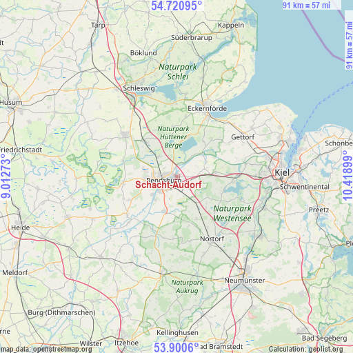
Schacht-Audorf GPS coordinates[2]
54° 18' 46.152" North, 9° 42' 57.096" East
| Map corner | latitude | longitude |
|---|---|---|
| Upper-left | 54.72095°, | 9.01273° |
| Center: | 54.31282°, | 9.71586° |
| Lower-right: | 53.9006°, | 10.41899° |
| Map W x H: | 91.2×91.2 km | = 56.7×56.7mi |
| max Lat: | 55.01917° ⇑3.6% North |
| Schacht-Audorf: | 54.31282° |
| min Lat: | ⇓96.4% South 47.40724° |
| min Long | Schacht-Audorf | max Long |
| 5.92978° | 9.71586° | 14.98853° |
| W 45.8%⇐ | ⇒54.2% E |
Elevation
Elevation of Schacht-Audorf is 10 m = 33 ft, and this is 239.1 m = 784 ft below average elevation for this country.
| Max E: |
1256 m = 4121 ft | 94.3% |
| Avg. | 249.1 m = 817 ft | |
| Schacht-Audorf | 10 m = 33 ft | |
Min E: |
-5 m = -16 ft | 5.7% |
See also: Germany elevation on elevation.city.
Geographical zone
Schacht-Audorf is located in North temperate zone (between Tropic of Cancer and the Arctic Circle). Distance of this North polar circle is 1362.2 km =846.4 mi to North.| Distance of | km | miles | from Schacht-Audorf |
|---|---|---|---|
| North Pole | 3968 | 2465.6 | to North |
| Arctic Circle | 1362.2 | 846.4 | to North |
| Tropic Cancer | 3433.1 | 2133.2 | to South |
| Equator | 6039 | 3752.5 | to South |


Nearby cities:
15 places around Schacht-Audorf: (largest is in red/bold)
• Alt Duvenstedt
7.4 km =4.6 mi,  324°
324°
• Borgstedt
2.2 km =1.4 mi,  349°
349°
• Büdelsdorf
2.9 km =1.8 mi,  282°
282°
• Bünsdorf
6.4 km =4 mi,  20°
20°
• Fockbek
7.7 km =4.8 mi,  259°
259°
• Haßmoor
6.7 km =4.2 mi,  102°
102°
• Holzbunge
7.9 km =4.9 mi, 352°
• Klein Wittensee
7.9 km =4.9 mi,  8°
8°
• Neu Duvenstedt
6.8 km =4.2 mi,  331°
331°
• Ostenfeld
4.2 km =2.6 mi,  85°
85°
• Osterrönfeld
2.7 km =1.7 mi,  203°
203°
• Rendsburg
3.5 km =2.2 mi, 258°
• Rickert
3.9 km =2.4 mi,  305°
305°
• Schülldorf
1.8 km =1.1 mi,  141°
141°
• Westerrönfeld
5.4 km =3.4 mi,  232°
232°
Sources, notices
• [Note1] Compared only with cities in Germany existing in our database
• [Src1] Map data: © OpenStreetMap contributors (CC-BY-SA)
• [Src2] Other city data from geonames.org with taken over terms of usage.
• [Src3] Geographical zone / Annual Mean Temperature by Robert A. Rohde @ Wikipedia
