Roxheim geodata
Roxheim (Rheinland-Pfalz) is a seat of a fourth-order administrative division; located in Germany in Europe/Berlin (GMT+2) time zone. With population of 2,375 people, there are 4583 cities with bigger population in this country. Compared to other cities in Germany, 67.5% of cities are located further ↑North; 80.8% of cities are located further →East and 59.2% of cities have higher elevation than Roxheim. Note1
Administrative division(s):
- Level 1: Rheinland-Pfalz
- Level 3: Landkreis Bad Kreuznach
- Level 4: Roxheim


Roxheim GPS coordinates[2]
49° 51' 49.464" North, 7° 48' 35.28" East
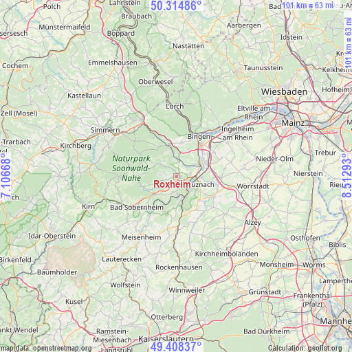
| Map corner | latitude | longitude |
|---|---|---|
| Upper-left | 50.31486°, | 7.10668° |
| Center: | 49.86374°, | 7.8098° |
| Lower-right: | 49.40837°, | 8.51293° |
| Map W x H: | 100.8×100.8 km | = 62.6×62.6mi |
| max Lat: | 55.01917° ⇑67.5% North |
| Roxheim: | 49.86374° |
| min Lat: | ⇓32.5% South 47.40724° |
| min Long | Roxheim | max Long |
| 5.92978° | 7.8098° | 14.98853° |
| W 19.2%⇐ | ⇒80.8% E |
Elevation
Elevation of Roxheim is 159 m = 522 ft, and this is 90.1 m = 296 ft below average elevation for this country.
| Max E: |
1256 m = 4121 ft | 59.2% |
| Avg. | 249.1 m = 817 ft | |
| Roxheim | 159 m = 522 ft | |
Min E: |
-5 m = -16 ft | 40.8% |
See also: Germany elevation on elevation.city.
Geographical zone
Roxheim is located in North temperate zone (between Tropic of Cancer and the Arctic Circle). Distance of this North polar circle is 1856.8 km =1153.8 mi to North.| Distance of | km | miles | from Roxheim |
|---|---|---|---|
| North Pole | 4462.7 | 2773 | to North |
| Arctic Circle | 1856.8 | 1153.8 | to North |
| Tropic Cancer | 2938.4 | 1825.8 | to South |
| Equator | 5544.3 | 3445.1 | to South |


Nearby cities:
15 places around Roxheim: (largest is in red/bold)
• Bad Kreuznach
4.8 km =3 mi,  121°
121°
• Braunweiler
4.3 km =2.7 mi,  274°
274°
• Gutenberg
2.3 km =1.4 mi,  342°
342°
• Hargesheim
1.4 km =0.9 mi,  96°
96°
• Hergenfeld
5.1 km =3.2 mi,  322°
322°
• Hüffelsheim
5.3 km =3.3 mi,  187°
187°
• Mandel
2.8 km =1.7 mi,  249°
249°
• Norheim
5.9 km =3.7 mi,  176°
176°
• Rüdesheim
2.1 km =1.3 mi,  170°
170°
• Sankt Katharinen
3.1 km =1.9 mi,  276°
276°
• Sommerloch
3.9 km =2.4 mi,  292°
292°
• Traisen
5.3 km =3.3 mi, 174°
• Wallhausen
3.8 km =2.4 mi,  305°
305°
• Weinsheim
4.6 km =2.9 mi,  222°
222°
• Windesheim
4.1 km =2.5 mi,  6°
6°
Sources, notices
• [Note1] Compared only with cities in Germany existing in our database
• [Src1] Map data: © OpenStreetMap contributors (CC-BY-SA)
• [Src2] Other city data from geonames.org with taken over terms of usage.
• [Src3] Geographical zone / Annual Mean Temperature by Robert A. Rohde @ Wikipedia
