Norheim geodata
Norheim (Rheinland-Pfalz) is a seat of a fourth-order administrative division; located in Germany in Europe/Berlin (GMT+2) time zone. With population of 1,438 people, there are 6003 cities with bigger population in this country. Compared to other cities in Germany, 68.7% of cities are located further ↑North; 80.7% of cities are located further →East and 63.3% of cities have higher elevation than Norheim. Note1
Administrative division(s):
- Level 1: Rheinland-Pfalz
- Level 3: Landkreis Bad Kreuznach
- Level 4: Norheim


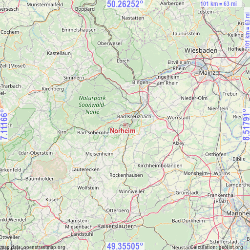
Norheim GPS coordinates[2]
49° 48' 39.276" North, 7° 48' 53.208" East
| Map corner | latitude | longitude |
|---|---|---|
| Upper-left | 50.26252°, | 7.11166° |
| Center: | 49.81091°, | 7.81478° |
| Lower-right: | 49.35505°, | 8.51791° |
| Map W x H: | 100.9×100.9 km | = 62.7×62.7mi |
| max Lat: | 55.01917° ⇑68.7% North |
| Norheim: | 49.81091° |
| min Lat: | ⇓31.3% South 47.40724° |
| min Long | Norheim | max Long |
| 5.92978° | 7.81478° | 14.98853° |
| W 19.3%⇐ | ⇒80.7% E |
Elevation
Elevation of Norheim is 130 m = 427 ft, and this is 119.1 m = 391 ft below average elevation for this country.
| Max E: |
1256 m = 4121 ft | 63.3% |
| Avg. | 249.1 m = 817 ft | |
| Norheim | 130 m = 427 ft | |
Min E: |
-5 m = -16 ft | 36.7% |
See also: Germany elevation on elevation.city.
Geographical zone
Norheim is located in North temperate zone (between Tropic of Cancer and the Arctic Circle). Distance of this North polar circle is 1862.7 km =1157.4 mi to North.| Distance of | km | miles | from Norheim |
|---|---|---|---|
| North Pole | 4468.6 | 2776.7 | to North |
| Arctic Circle | 1862.7 | 1157.4 | to North |
| Tropic Cancer | 2932.5 | 1822.2 | to South |
| Equator | 5538.5 | 3441.5 | to South |


Nearby cities:
15 places around Norheim: (largest is in red/bold)
• Altenbamberg
3.3 km =2.1 mi,  156°
156°
• Bad Kreuznach
5.1 km =3.2 mi,  47°
47°
• Bad Münster am Stein-Ebernburg
2.2 km =1.4 mi,  88°
88°
• Feilbingert
5 km =3.1 mi,  192°
192°
• Hallgarten
6 km =3.7 mi,  197°
197°
• Hargesheim
5.8 km =3.6 mi,  9°
9°
• Hochstätten
5.1 km =3.2 mi, 164°
• Hüffelsheim
1.2 km =0.7 mi,  301°
301°
• Mandel
5.7 km =3.5 mi,  328°
328°
• Niederhausen
2.6 km =1.6 mi,  241°
241°
• Roxheim
5.9 km =3.7 mi,  356°
356°
• Rüdesheim
3.8 km =2.4 mi, 359°
• Schloßböckelheim
4.8 km =3 mi,  255°
255°
• Traisen
0.7 km =0.4 mi, 11°
• Weinsheim
4.3 km =2.7 mi,  305°
305°
Sources, notices
• [Note1] Compared only with cities in Germany existing in our database
• [Src1] Map data: © OpenStreetMap contributors (CC-BY-SA)
• [Src2] Other city data from geonames.org with taken over terms of usage.
• [Src3] Geographical zone / Annual Mean Temperature by Robert A. Rohde @ Wikipedia
